Ceuta, a small yet strategically vital city on the northern tip of Africa, has a history as rich as it is complex. Its geographic position at the entrance to the Mediterranean Sea shapes its story, which spans millennia and is a mix of cultural, economic, and military significance.
Today, Ceuta is one of Spain’s autonomous cities. The city faces challenges, particularly as a focal point of migration from Africa to Europe, and remains a politically sensitive area, with Morocco claiming sovereignty over it.
History
Ceuta’s history begins with the Phoenicians around the 7th century BCE, who established a settlement they called Abyla. This was a key point in their trade routes, connecting the Atlantic and Mediterranean worlds. Over the centuries, the Carthaginians and later the Romans took control of the region. Under Roman rule, Ceuta, known as Septem, became a key administrative and military post. Its proximity to the Iberian Peninsula gave it immense strategic value for controlling maritime traffic.
With the decline of the Roman Empire, Ceuta saw successive waves of conquests. The Vandals, Byzantines, and Visigoths each held sway over the city at various times. In 710, Ceuta became a staging ground for one of history’s pivotal moments: the Islamic conquest of the Iberian Peninsula. The Berber leader Tariq ibn Ziyad launched his invasion from near Ceuta, crossing the Strait of Gibraltar and setting off centuries of Islamic rule in Spain.
For much of the medieval period, Ceuta was governed by Muslim dynasties, including the Umayyads, Almoravids, and Almohads. It flourished as a trade centre, linking the Islamic world with sub-Saharan Africa and Europe.
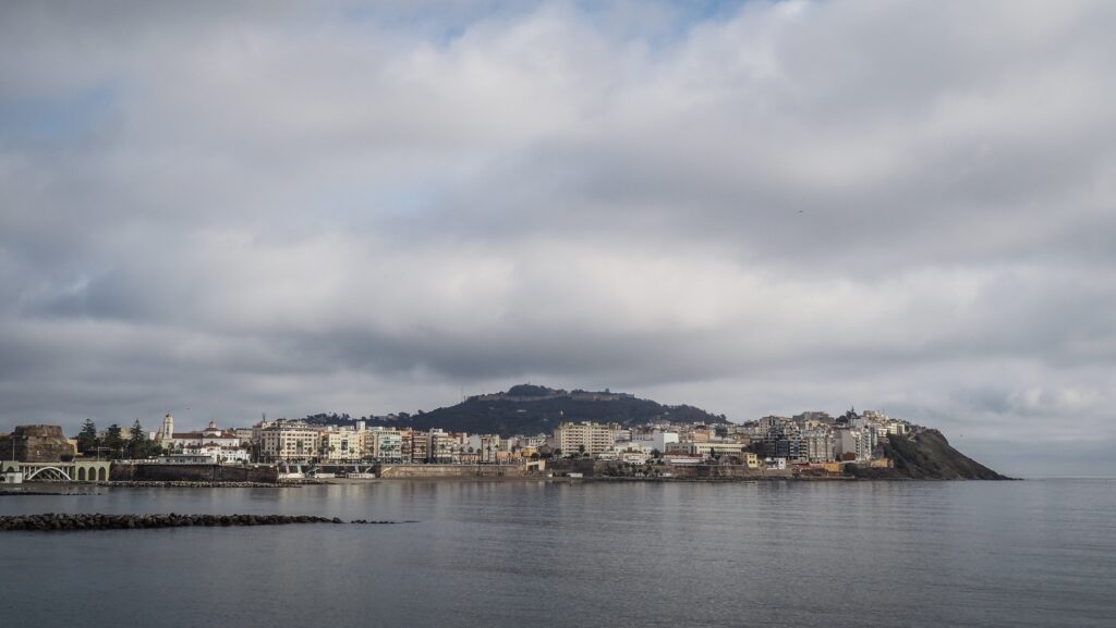
In 1415, Ceuta underwent a dramatic shift when Portugal conquered it. This marked the beginning of European colonial expansion into Africa. The Portuguese saw Ceuta as a key to controlling trade in gold, spices, and slaves from Africa and as a foothold against Muslim powers. However, the conquest also disrupted traditional trade networks, diminishing the city’s economic vitality.
When Portugal and Spain united under the Iberian Union in 1580, Ceuta effectively came under Spanish influence. Even after Portugal regained independence in 1640, Ceuta chose to remain under Spanish sovereignty. This decision set the stage for its modern status as a Spanish enclave in Africa.
During the 18th and 19th centuries, Ceuta evolved into a fortified Spanish outpost, reflecting its importance in European geopolitics. The city became a penal colony for Spain, housing political prisoners and convicts. Its strategic location again came to prominence during the 20th century, particularly during the Spanish Civil War and the era of decolonization in Africa.
How to get there?
Getting to Ceuta involves travelling to the northern tip of Morocco or southern Spain, as it is a Spanish enclave on the African continent.
By Ferry
The most common way to reach Ceuta from Spain is by ferry from Algeciras, a port city on Spain’s southern coast near Gibraltar. Several ferry companies operate daily trips, with the journey taking about 1–1.5 hours. Ferries accommodate passengers, vehicles, and cargo, making it convenient if you plan to drive around Ceuta.
You can also reach Ceuta indirectly by taking a ferry from southern Spain (e.g., Algeciras) to Tangier and then travelling overland to the border.
By Land
Ceuta is directly adjacent to Morocco, and you can cross the border at Tarajal, near the Moroccan city of Fnideq (also called Castillejos). To cross the border, you’ll need proper documentation: EU/Schengen citizens usually just need a passport while non-EU citizens may require a visa to enter Ceuta (treated as EU territory).
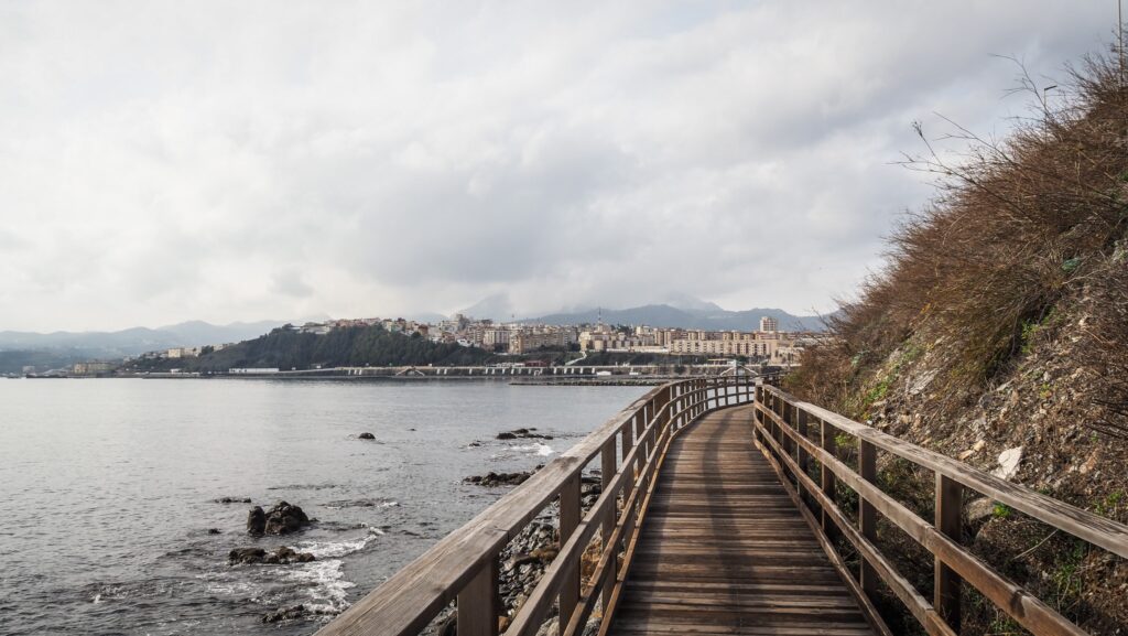
It’s a pleasant 3-kilometre walk along the seaside from the border to the city centre. Highly recommended if you don’t travel with heavy luggage. Otherwise, you may look for a city bus.
By Taxi or Bus
From major Moroccan cities like Tetouan or Tangier, you can take a bus or taxi to Fnideq and then walk across the border to Ceuta. The journey from Tangier to Fnideq takes about 1.5–2 hours by road.
How to get around Ceuta?
Getting around Ceuta is relatively easy due to its small size, compact layout, and well-maintained infrastructure.
Ceuta’s main attractions, such as the Royal Walls (Murallas Reales), Plaza de África, and the Cathedral, are located within walking distance of each other in the city centre. The promenade along the waterfront is particularly scenic and pedestrian-friendly.
A network of urban buses connects the city centre with outlying neighbourhoods and key spots, including beaches. Fares are affordable, and buses are reliable for short distances.
Taxis are plentiful and can be hailed on the street or at taxi stands near the ferry terminal, major hotels, and popular attractions. Taxis use meters, but it’s good to confirm the price before starting longer trips.
Ceuta has good roads, and parking is available, though it may be limited in the busy city centre.
The best time to visit
The best time to visit Tangier largely depends on your preferences for weather, activities, and crowd levels.
Spring (March to May)
Pleasant temperatures averaging 15–23°C. Ideal for exploring the city, walking tours, and outdoor activities like hiking on Monte Hacho. Flowers are in bloom, making it a beautiful time for photography and scenic views.
Summer (June to August)
Warm to hot weather, with temperatures ranging from 22–30°C. Perfect for enjoying Ceuta’s beaches like Playa de la Ribera or Playa del Chorrillo. Clear skies and long days for outdoor activities. The busiest time of year, as it coincides with the European and Moroccan holiday seasons. Higher accommodation prices and hotter conditions for city sightseeing.
Autumn (September to November)
Warm, comfortable temperatures averaging 18–25°C. The sea is still warm from summer, making it great for swimming without the crowds. A quieter time to explore the city’s historical sites.
Winter (December to February)
Mild winter weather, with temperatures around 12–18°C. Perfect for walking tours and exploring historical sites without worrying about heat. Lower accommodation prices and fewer tourists. Cooler weather makes swimming and some outdoor activities less appealing.
Where to stay?
I was looking for a budget private room and got one in Hostal Plaza Ruiz. It was located in the city centre along a busy shopping street. The room and bathroom were very small but it was alright for a short stay as I was spending most of the time outside the room anyway.
What to see in Ceuta?
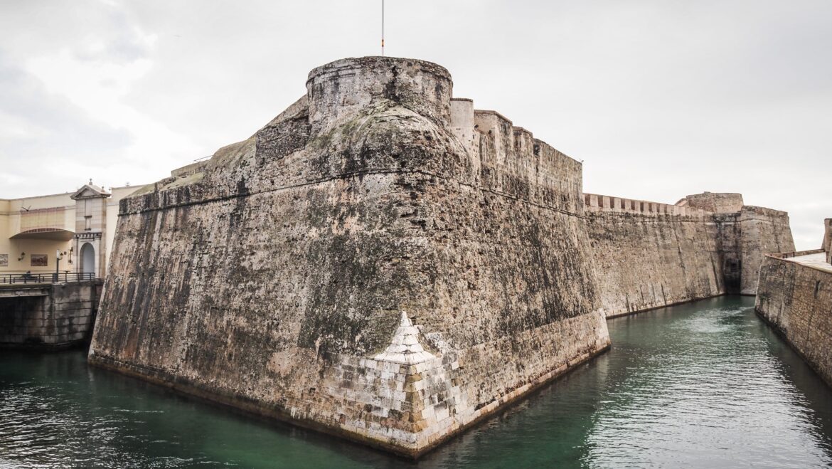
Ravelin of Saint Ignatius and the Royal Walls of Ceuta
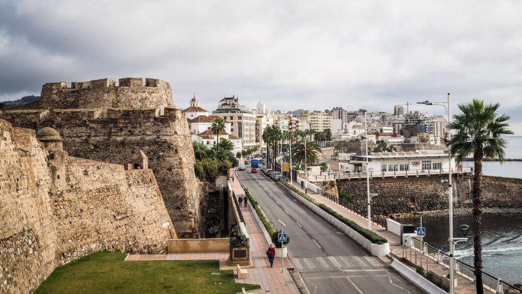
Ancient Ceuta was bounded by the Royal Walls Monumental Complex. The Royal Moat, which has been navigable since the time of Portuguese dominion, is located beyond the Walls. East of this Moat lie the oldest fortresses of the Walls: the Fortresses of Bandera and Coraza Alta y su Caballero, as well as the Mallorquines Fortress, which houses the city’s tourism office. As a defence mechanism, the Bridge of Christ, which connected the Walls and the Mallorquines Fortress, could be raised in the past. At a specific point in the afternoon, a cannon shot was fired to indicate that it would be closed, cutting off the city from the surrounding area.
The parade field is surrounded by Saint Francis Xavier’s Counterguard, Saint Paul’s Fortress, and Saint Ignatius’ Ravelin. There is a free museum located inside the last one, presenting paintings in three main areas based on the origin of the artists: Ceuta, those linked to the City and the School of Tetouan.
Shrine of Our Lady of Africa
The Virgin of Africa is Ceuta’s patron saint. Henry the Navigator, the Infante of Portugal, brought the statue in 1418. The 600th anniversary of the Virgin of Africa’s arrival in Ceuta was commemorated in 2018.
Cathedral of the Assumption
A rudimentary Eastern Roman Christian church stood here before the incredibly wealthy Great Mosque of Ceuta took its place. There is no documentation of the changes made to the Great Mosque to convert it into a Christian church following the Portuguese conquest in 1415. After the edifice was destroyed by war-related events and the passage of time, a new church constructed by architect Juan de Ochoa was chosen to replace it around the end of the 17th century. Construction started in 1686, but the new cathedral wasn’t consecrated until 1726 because of the severe siege that Ceuta endured.
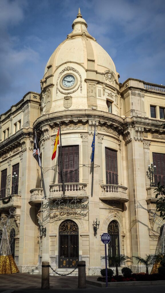
Palace of Assembly
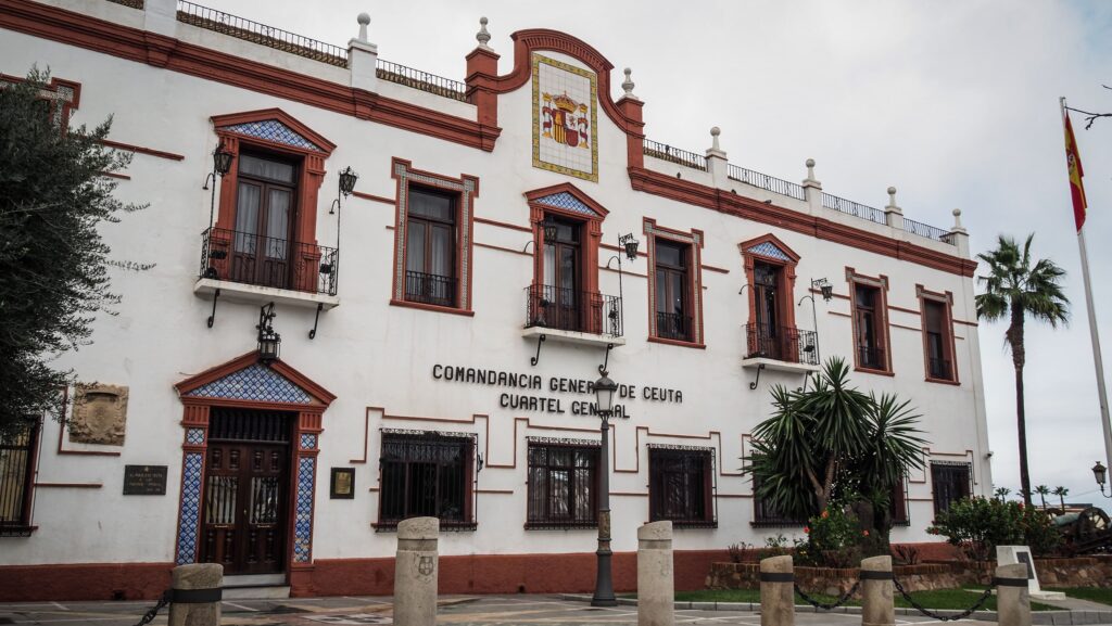
The elegantly designed building was inaugurated in 1927 by King Alfonso XIII and Doña Victoria Eugenia. Its interior features the French-style Throne Room, decorated with frescos by the artist Mariano Bertuchi. It also has a Meeting Room adorned with Spanish Renaissance-style furniture. The facade is very beautiful and well-preserved.
Tardorromana Basilica Museum
The architectural remnants of an old basilica, including a bridge over open tombs with skeletons, were found during street work in the 1980s and are combined into this masterfully designed underground museum. Unfortunately, no captions in English.
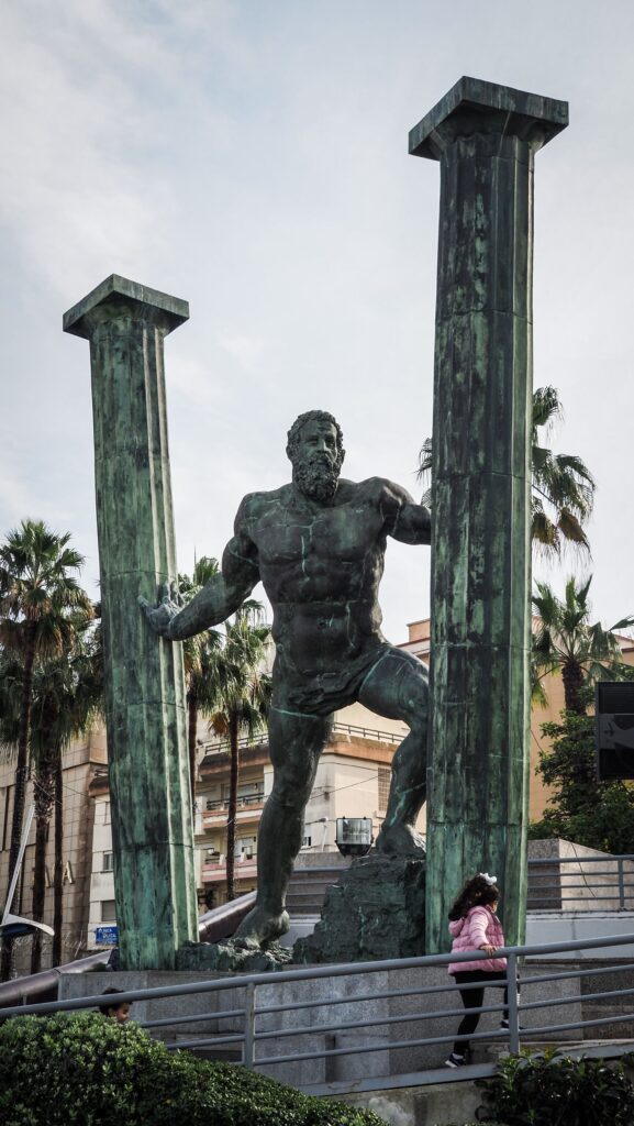
Statue of Hercules
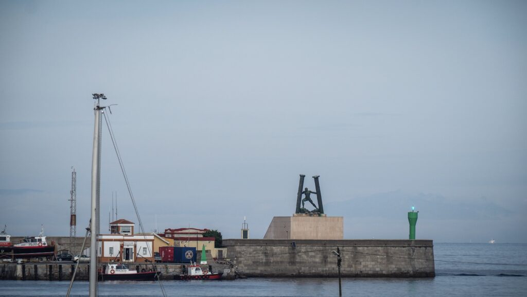
The connection between Hercules and the Strait of Gibraltar is rooted in Greek and Roman mythology, where the hero Hercules (Heracles in Greek mythology) is said to have played a key role in shaping the geography of the region during one of his legendary Twelve Labors.
One of these labours involved travelling to the far western edge of the known world to capture the cattle of Geryon, a fearsome three-bodied giant who lived on the island of Erytheia (often identified with the Iberian Peninsula or nearby regions).
On his journey to Erytheia, Hercules faced a massive mountain range that blocked his path. To pass through, Hercules either smashed through the mountains with his immense strength, separating Europe and Africa, and allowing the Atlantic Ocean to flow into the Mediterranean or pulled the mountains apart, creating the two towering landforms that stand on either side of the Strait of Gibraltar.
These landforms became known as the Pillars of Hercules, symbolizing the gateway to the unknown and marking the westernmost boundary of the ancient world. The northern pillar is traditionally identified as the Rock of Gibraltar, located on the European side. The southern pillar is less definitively identified but is often associated with Jebel Musa, a mountain in Morocco, or Mount Hacho near Ceuta.
Museum of Revelin
A very small museum with archaeological exhibits. All of the artefacts were discovered in the sites in the heart of the urban area. There are explanatory panels about the original location of the finds as well as the daily life of the families who used the utensils and ornaments on display.
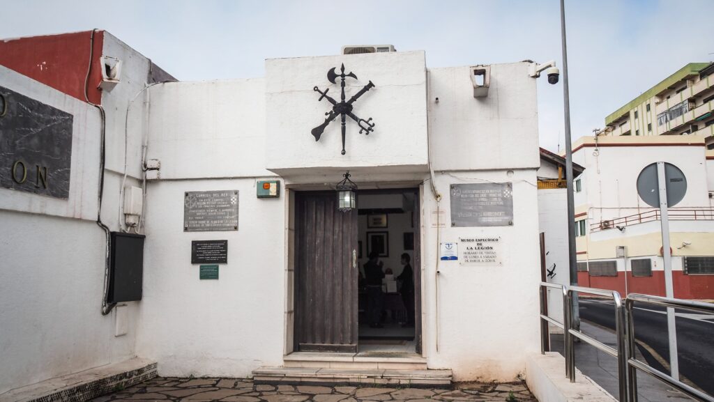
Military Museum of the Legion
The Military Museum of the Legion was established in 1940 to celebrate the Spanish Legion. The Legion and its museum moved to Ceuta in 1956 when Morocco gained independence from Spain.
Weapons, uniforms, flags, and other things taken from the enemy during the conflicts in which the Legion had fought are all part of the Legion Museum’s collection.
Mediterranean Maritime Park (Parque Marítimo del Mediterráneo)
Three huge well-maintened pools right beside the marina, filled with salty and very cold water! There are also some food options and plenty of sunbeds.
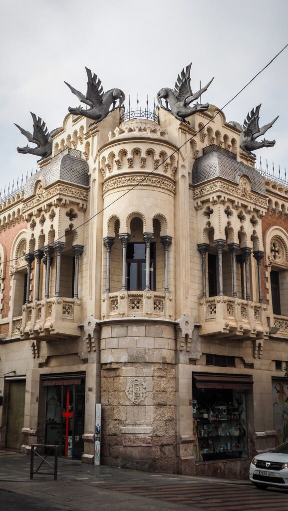
Casa de los Dragones
Designed by Valencian architect José M. Cortina Pérez and finished in 1905, the structure was commissioned in 1900 by Francisco Cerni González, who served as mayor of Ceuta from 1897 to 1903, in collaboration with his brother Ricardo.
The house’s subsequent owners were Ricardo’s sons. This was the location of the Spanish Falange party’s offices following the 1936 revolution. In 1946, the house was sold. Salomón Benhamú Roffé paid for the facade’s repairs in 1973 and 1996.
The original dragons were removed in 1925 and lost, but four new dragons have been designed by Antonio Romero Vallejo.
Unfortunately, the interior is closed to visitors.
Church of Saint Francis
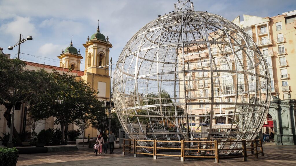
IA characteristic yellow, twin-towered, Baroque edifice that lies beside the Plaza de los Reyes. It was constructed in the early eighteenth century in honour of the Holy Cross and is known for its Baroque altarpieces and images of the Virgin and Christ.
Plaza de Los Reyes
Adjacent to the twin-towered yellow Church of Saint Francis is this plaza with its green triumphal arch and fountain. A statue honouring Ceuta’s holy week in the northwest corner depicts a father holding hands with a child while wearing a capirote, a conical hooded hat.
Arab Baths (Baño árabe de la plaza de la Paz)
Public baths were located near the Medina quarter’s northern outskirts. Remains of a roadway and a household building from the 11th-century show that this location was inhabited around that time. The two baths weren’t constructed until the 12th and 13th centuries. According to archaeological studies conducted in 2000 and 2004, the baths featured a single room for clothing and toilets, followed by a cold and then a hot bath in the Roman style.
Mirador Batería del Espino o del Pintor (Viewpoint)
Definitely worth the uphill climb for the beautiful views of Ceuta and the Mediterranean Sea.
Hacho Mountain (Monte Hacho)
Monte Hacho is situated on a peninsula that juts into the Mediterranean Sea. Its strategic position has made it a key point for controlling maritime traffic through the Strait of Gibraltar. Along with Gibraltar on the European side of the strait, Monte Hacho is sometimes considered one of the Pillars of Hercules, an ancient geographical concept marking the entrance to the Atlantic Ocean from the Mediterranean.
One of the key features of Monte Hacho is the Fortaleza del Monte Hacho (Fortress of Monte Hacho). This fortress has served multiple roles throughout history, including as a defensive stronghold, a prison, and a military installation.
The exact origins of the fortress are uncertain, but it is believed to date back to the Byzantine or Moorish periods. Some sources suggest it may have been built during the 6th or 7th century when the Byzantines were reinforcing their control over the North African coast.
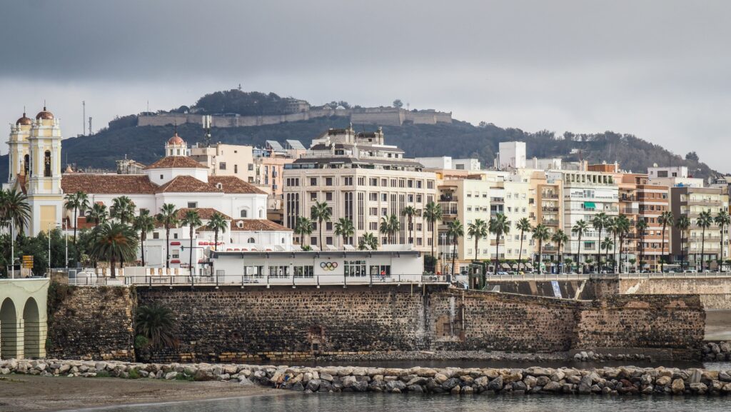
During the Islamic rule of North Africa and the Iberian Peninsula, the fortress was likely expanded and fortified as part of the broader defensive network in the region.
After Ceuta was taken by the Portuguese in 1415 and subsequently transferred to Spanish rule in the 17th century, the fortress was further fortified. The Spanish turned it into a key defensive structure to protect Ceuta from potential invasions, particularly during the conflicts with Morocco and other regional powers.
Over time, the fortress served various roles, including as a prison and a military garrison. Today, parts of it are still used by the Spanish military, though it is also a site of historical and cultural interest.
Monte Hacho is also surrounded by natural beauty, with trails and scenic spots making it a popular destination for hiking and outdoor activities. However, the fortress is closed to visitors.
Castle of Santa Catalina (Castillo de Santa Catalina)
The park with the ruins of the castle is quite neglected, although the views of the Strait of Gibraltar are nice.
Punta Almina Lighthouse (Faro Punta Almina)
It was designed by Juan Martínez de la Villa in 1851. The building is made of masonry and a white cylindrical tower. The focal height is 145.17 m above sea level, with a range of 22 nautical miles. Nearby are the ruins of the old fort (Fortin de Punta Almina).
Fort of El Desnarigado (Castillo del Desnarigado)
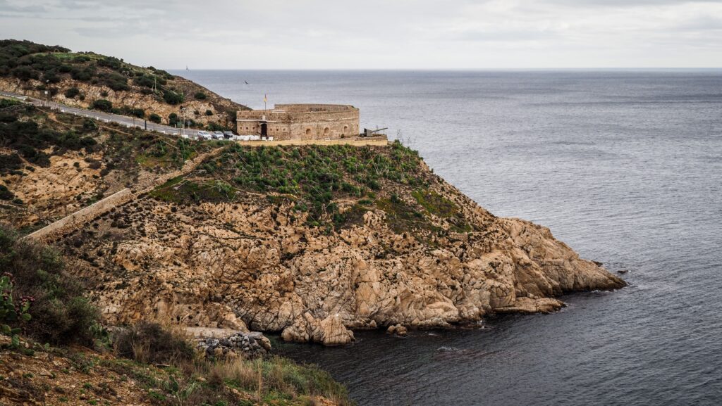
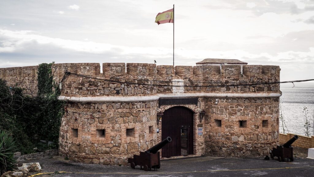
The exact date of its construction is uncertain, but the castle is believed to have been built during the 19th century as part of Ceuta’s defensive network. It was designed to protect the city from potential naval and land attacks.
The Castillo del Desnarigado is no longer used for military purposes and has been repurposed as a cultural and historical site. It houses a military museum, where visitors can explore exhibits about the history of Ceuta, including its military past and maritime significance.
Desnarigado Cove (Cala del Desnarigado)
A beautiful place to go swimming or just to watch the sunset. The beach is with stones, but it’s extremely calm with very few people.
Beaches
The beaches in Ceuta vary from urban stretches with amenities to quieter, more natural spots.
Playa de la Ribera and Playa del Chorillo are the closest to the city centre. A bit further, but still easily accessible with public transport are Playa San Amaro, Playa Benítez, Playa Calamocarro and Playa de Benzú.
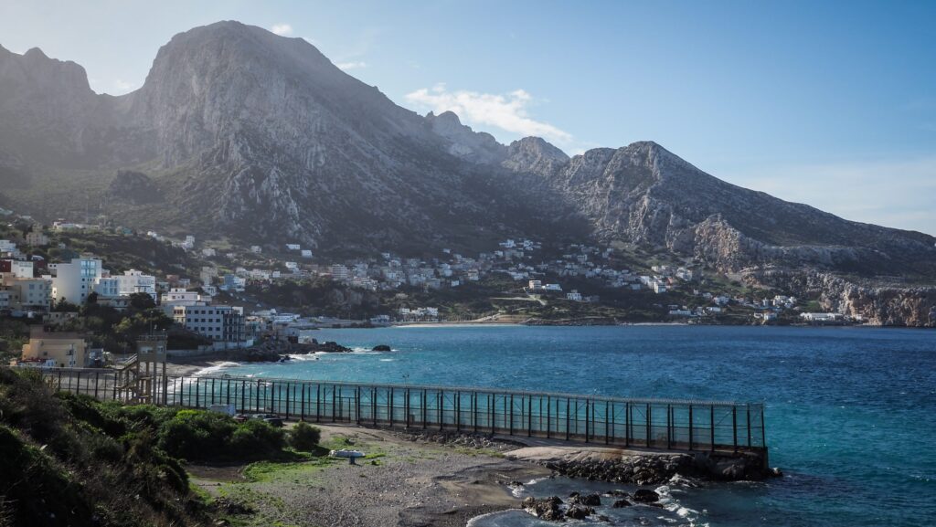
Mirador de Benzu
Spectacular views at the place where mountains meet the sea. You may notice the Ceuta border fence, which separates it from Morocco. Easily accessible with bus #5.
Mirador de Beliunes and Mirador de Isabel II
These viewpoints have some great panoramas but are located inland, along N-362 road so they are more difficult to reach. Private transport is essential unless you like long walks 🙂

