Tag

desert

Browsing

Merzouga is a small village on the edge of the Sahara Desert in southeastern Morocco, known for its towering sand dunes, stunning landscapes, and as a gateway to the vast, golden stretches of the Erg Chebbi. These dunes can reach heights of up to 150 meters and extend over an area of approximately 28 kilometres, creating a surreal, otherworldly landscape that feels remote and ancient.

Merzouga has a unique atmosphere shaped by its desert setting and is celebrated for its vibrant yet tranquil ambience. The village itself is modest and rooted in Berber (Amazigh) culture, with people speaking a mix of Tamazight, Arabic, and French.

The region has become a popular destination for adventurers and cultural travellers who want to experience the Sahara up close. Camel treks at sunrise or sunset are popular, giving visitors the chance to ride through the dunes and witness the landscape’s constantly shifting colours in the warm desert light. Many opt to stay in desert camps under the stars, where traditional Berber meals like tagine are served, often accompanied by live drumming around a campfire.

The ecosystem around Merzouga, despite the arid conditions, is surprisingly rich. During certain times of the year, especially after rain, Merzouga sees migratory birds like flamingos visit its seasonal salt lake, Dayet Srji. The desert’s flora and fauna are specialized to endure extreme conditions, showcasing the adaptability of life in one of Earth’s most challenging climates. Nearby, you’ll find fascinating geological sites and fossil deposits dating back millions of years, along with old kasbahs and ksars (fortified villages) that provide insight into Morocco’s history and the Saharan trade routes that once passed through the area.

How to get there?

Getting to Merzouga can be an adventure in itself, as it’s in a remote part of Morocco near the Algerian border. Here are the main ways to get there, depending on your starting point, time, and budget.

Merzouga, Morocco
Merzouga

By Car

From Marrakech

The drive is around 9–10 hours (560 km) and passes through the High Atlas Mountains, the Tizi n’Tichka Pass, Ouarzazate, and the Draa Valley. Many people split the trip over two days, often stopping overnight in places like Ait Benhaddou or Dades Valley.

From Fes

The drive takes about 7–8 hours (470 km). You’ll pass through scenic towns like Ifrane, Midelt, and Erfoud, a fossil-rich area that’s also a gateway to the desert.

By Bus

Supratours has a direct, overnight bus from Marrakech and Fes to Merzouga. The journey from Marrakech takes around 12 hours and the one from Fes about 10 hours. The bus arrives in Merzouga early in the morning, allowing you to start desert tours the same day. The buses are typically comfortable and air-conditioned, though the ride is long. It’s recommended to book tickets in advance, especially during peak travel seasons.

By Plane

While Merzouga doesn’t have an airport, the closest ones are in Errachidia and Ouarzazate. Royal Air Maroc operates limited flights from Casablanca to Errachidia. From Errachidia, Merzouga is a two-hour drive by taxi or private transfer. Ouarzazate Airport (OZZ) is another option, but it’s farther away (about 5–6 hours by car).

Powered by 12Go system
Merzouga, Morocco
At the dunes

By Private Transfer or Organized Tour

If you prefer a hassle-free journey, many companies offer multi-day tours that include transport to and from Merzouga, typically starting from Marrakech or Fes. These often include stops at scenic and cultural sites along the way, such as Ait Benhaddou, the Todra Gorge, and the Valley of the Roses. You’ll travel in a comfortable 4×4 or minivan with a guide. Shared group tours are more budget-friendly and include similar stops but may be less flexible.

Once in Tinghir, you can easily hire a “grand taxi” to take you directly to Todra Gorge. The distance is about 15 kilometres, and the trip takes 20–30 minutes. Taxis can be shared or hired privately, depending on your preference.

Many travellers opt for guided tours from major cities like Marrakech, which often include transport, local guides, and stops at other attractions like Ouarzazate and the Dades Valley. These tours range from one-day excursions to multi-day trips and are a convenient option for those who prefer organized travel.

Where to stay?

I stayed in Auberge Kasbah Des Dunes which was a great choice. The room was very atmospheric, there was a lot of parking space plus a delicious breakfast was included. The owner also helped me to organize an overnight desert experience at Erg Chebbi.

The best time to visit

Spring (March to May): temperatures are warm but comfortable, typically ranging from 20°C to 30°C during the day and cooler in the evenings. This is a beautiful time for desert landscapes, as the sand and skies are vivid, and occasional spring rains may create rare blooms in the desert. Spring is popular with tourists, especially in April, so booking accommodations or desert tours in advance is recommended.

Autumn (September to November): similar to spring, temperatures are mild, with daytime highs around 25°C to 30°C and cooler evenings. October is especially pleasant. Clear skies and beautiful sunsets make autumn a favourite for photographers and those looking to experience the desert at its most vibrant. Autumn also sees a fair number of tourists, but generally fewer than spring. It’s still wise to book ahead, especially in October.

Merzouga, Morocco

Winter (December to February): days are mild, with temperatures between 15°C to 20°C, but nights can be cold, dropping close to freezing in the desert. The winter sky is often crisp and clear, which is perfect for stargazing. If you’re prepared for the cold nights, winter can be a magical time to experience the desert’s tranquillity. Winter is less crowded, though the holiday period around late December can be busy.

Summer (June to August): daytime temperatures soar, often reaching 40°C to 50°C, making it challenging for outdoor activities. Most tours run early in the morning or late in the afternoon to avoid the midday heat, and many desert camps close or operate with limited services. Fewer tourists visit in summer due to the heat, making it an option for those who want to avoid crowds, but only if you’re comfortable with intense temperatures.

Merzouga, Morocco

Erg Chebbi

The most famous sand dune region in Morocco spans about 28 kilometres in length and 5–7 kilometres in width, creating a vast sea of reddish-orange sand that stretches to the horizon. Erg Chebbi is often called Morocco’s “gateway” to the Sahara because it offers one of the most accessible ways to experience the true Sahara Desert. While not as vast as the Sahara further east, the experience of walking, riding camels, or camping among these dunes provides an authentic taste of the desert’s allure.

Popular activities include camel trekking, sandboarding, 4×4 off-road excursions, and quad biking. These activities allow visitors to explore the dunes from different perspectives and provide a mix of adventure and relaxation.

Merzouga, Morocco
Panorama of Erg Chebbi dunes

I went to Erg Chebbi three times: twice independently and once while heading to the desert camp. If you go independently, the dunes can be accessed from many points. Once, I parked near the National 4X4 Auto Museum and set off from there, and at another time I simply walked towards the dunes from my accommodation Auberge Kasbah Des Dunes. Climbing the highest one was huge fun! Not an easy job as my feet sank into the sand but very scenic views from the top! I could hear quads in the distance as the dunes were also a playground for such activities.

Be careful as sometimes strong winds can blow sand straight into your face. It’s good to have some kind of face cover.

Merzouga, Morocco
Erg Chebbi at sunset

Overnight at the desert camp

Camel trekking is one of the most popular ways to explore Erg Chebbi. Many visitors take a camel ride into the heart of the dunes, often timed for sunrise or sunset to capture the changing colours of the sands. Overnight stays in traditional Berber desert camps are also popular, with accommodations ranging from basic tents to luxurious setups, allowing for an immersive experience under the stars. I arranged my trip through the accommodation upon arrival to Merzouga and I advise you to do the same for the best price.

The start of the trip was planned at 4 PM but it was slightly delayed as we were waiting for 3 more people to join but seemed that they were still on their way. Finally, I set off alone with the guide as they were not even sure if the other guests would come or not. The ride on the camel was a surprisingly long and super nice experience, even though as always the ass hurt and in general I never feel good riding on any type of animal.

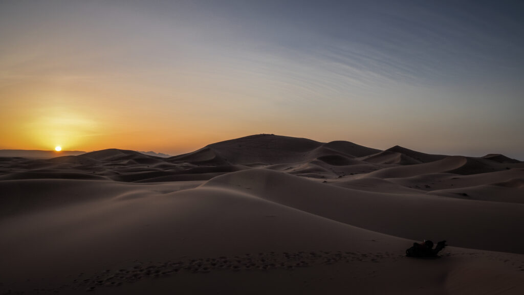
We made a short stop to admire the sunset and then continued to the camp. The camp was really small, basically 3 tents for guests, one for the kitchen and one for dining.

Merzouga, Morocco
Camp on the desert

I was sure I was going to be the only guest which would be quite a boring and miserable experience but then my guide came with dinner and said that the other 3 guests were on their way. It was an American girl and two guys from New Zealand. I didn’t get along with them as I could hardly understand their accent and what the hell they were talking to me 🙂 Plus they were young teenagers and some of their behaviours proved that.

After dinner, we went out a bit deeper into the desert to go sandboarding and look for the desert fox. Unfortunately, none of us had a proper headlamp so we could see shadows of foxes moving around but not very clearly. Sandboarding was cool but in the total darkness, I couldn’t even see where I was going and it was so tiring to climb back to the dune! So a great tip: take a strong headlamp! For me, sitting in the desert looking at the night sky full of stars was an absolute highlight. In moments like that, I could feel that I was halfway between space and Earth. We even saw some shooting stars!

In the morning we woke up for sunrise. It was pretty cold so I was glad that I took some extra layers! After that, we went back to the village riding the camels. I had breakfast in the accommodation and then took a shower. It was very nice that they gave me this opportunity even after checkout time, as my skin was full of sand!
Merzouga, Morocco
Sunset around the camp

National 4×4 Auto Museum

According to the reviews, the museum features a wide variety of antique 4×4 cars from different eras, all in excellent condition. It’s free but a donation to the guard is welcome. Unfortunately, at the time of my visit, it was closed even though opening hours said it should have been open.

Ouzina

Ouzina is a small village about 60 kilometres south of Merzouga. The local people live in a way that reflects their deep connection to the desert environment, often in adobe houses, and maintain traditional practices, including crafting and agriculture adapted to arid conditions. It is less visited than Merzouga, making it ideal for travellers seeking a more off-the-beaten-path desert experience.

Reaching Ouzina is a bit challenging due to its remote location. Travelers usually take a 4×4 vehicle from Merzouga or Rissani, navigating unpaved desert roads. Many organized tours include Ouzina as part of a multi-day Sahara excursion.

I followed the N13 road to the south, to check how far I could go with Renault Clio. The landscape changed and the terrain was more rocky, without high dunes. Soon, roadworks started and the surface turned into a combination of sand and small stones so I decided to turn back. If you have a 4X4, you can drive all the way to Zagora. It must be an amazing off-road experience!

Merzouga, Morocco
Desert landscape en route to Ouzina

Sijilmassa Archeological Site and Rissani

From the 14th to 18th century, Sijilmassa was the desert capital and a hub for trading gold and slaves across the Sahel.

Caravans of camels left Sijilmassa for the remote desert salt mines of Taodeni and Tagahaza (modern-day Mali), then travelled to Niger and Ghana, where a pound of Saharan salt was sold for one ounce of African gold. By the 12th century, Sudanese gold purified in Sijilmassa had reached Europe and was coined into European coins.

The city collapsed in the 14th century due to internal conflict. Alawite Sultan Moulay Ismail rebuilt it in the 18th century, but it was eventually destroyed by nomadic fighters from Aït Atta.

Today, the town’s name is Rissani and it is no longer the vibrant place it once was. The 17th-century ksar houses only a fraction of the population, while the modern town consists of just one street and plaza. Few ruins of Sijilmassa remain, but you can wander around freely and use your imagination to feel the grandeur of the ancient city.

If you have some extra time, it’s worth driving about 20 20-kilometre loop along P7107 road through Ksar Guighlane, Ksar Tazegzout and Ksar Jdid El Ghorfa. A lot of great architecture with crumbling kasbahs, but unfortunately as soon as you leave the car, you are surrounded by “guides” who simply don’t want to leave you alone and explore in peace.

Gara Medouar

A striking rock structure that resembles a circus and serves as a natural stronghold, located at 850 meters above sea level. Although the formation appears to be a volcano or a crater, it is an eroded rock from millions of years ago.

In the eleventh century, Gara Medouar was transformed into a castle with a garrison. It probably safeguarded the trade routes from the south as well as the surrounding trading city of Sijilmasa, which produced gold coins. In the seventeenth century, the stronghold was abandoned. Portuguese prisoners of war were housed in Gara Medouar throughout the 1800s. This is how the “Portuguese Prison” gained its moniker. The inmates were made to labour in the quarries and mines in the area. Many of them passed away from illness or fatigue.

Gara Medouar is located 7 km west of the town of Rissani. Look for the turn-off from well-maintained N12 and follow the last 3 km on a gravel route to reach the slope. In optimal weather conditions, it’s possible to reach the place in a 2WD car. Just drive carefully!

Merzouga, Morocco
Gara Medouar
Merzouga, Morocco
Gara Medouar

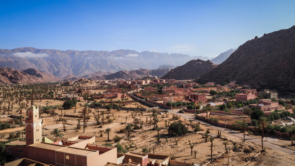
Tafraoute is a small town in southern Morocco, located in the Anti-Atlas mountains in the Souss-Massa region. Its history is deeply connected to its geography and Berber heritage.

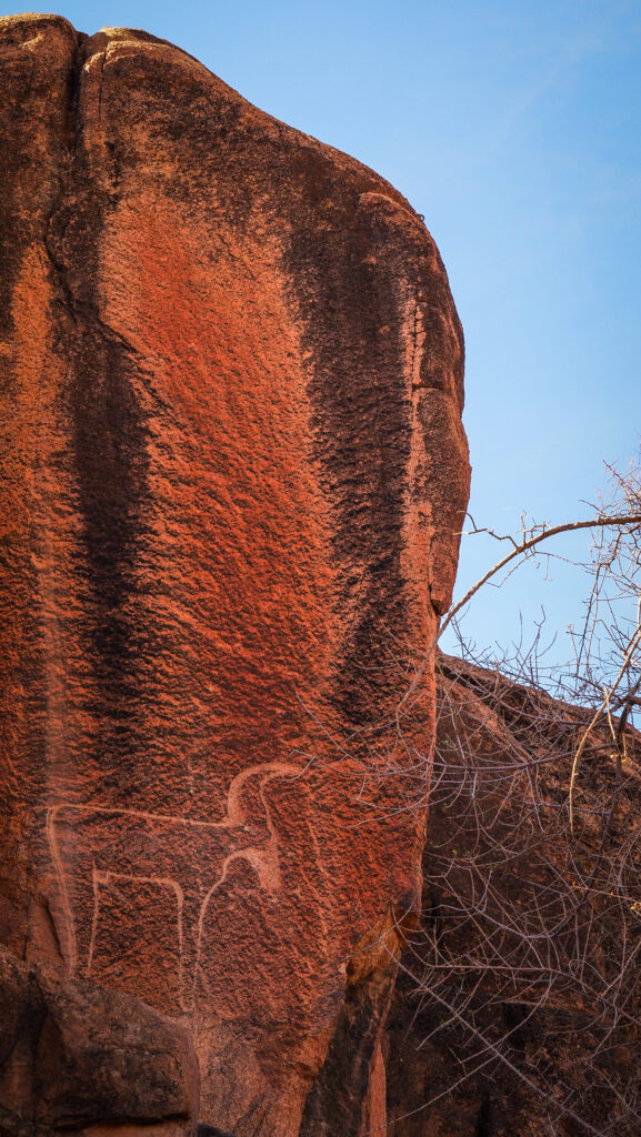
Prehistoric rock carvings and petroglyphs found in the area suggest that early human settlers lived here as far back as the Neolithic period. These carvings depict animals such as gazelles, cattle, and giraffes, showing that the region was once more verdant.

The town is at the heart of a region primarily populated by the Berbers, also known as the Amazigh people, the indigenous inhabitants of North Africa. The Berbers of Tafraoute have a long history of resilience and cultural preservation. Throughout history, they resisted outside rule, including from Phoenician, Roman, and later Arab conquests, maintaining their distinct language, culture, and traditions. Tafraoute is in the territory of the Shilha-speaking Berbers, one of the many Berber language groups in Morocco. Over centuries, the people of this area were known for their semi-nomadic lifestyles, agriculture, and trade across the Sahara.

With the arrival of Islam in the 7th and 8th centuries, Tafraoute, like other parts of Morocco, gradually embraced the new religion. However, the mountainous and isolated nature of the region allowed the local Berber population to maintain a degree of autonomy. During the rule of the Almoravid and Almohad dynasties (11th to 13th centuries), Tafraoute remained part of the broader Moroccan realm, but due to its remote location, it was largely on the periphery of political and military conflicts.

Morocco became a French protectorate in 1912, though the Anti-Atlas region remained difficult for French authorities to control. Tafraoute, with its rugged terrain, was a natural refuge for those resisting colonial rule. The town and its surrounding villages played a role in the Berber resistance movements, especially in the 1920s and 1930s. Berber tribes in this region were fiercely independent, and many revolted against French rule. The colonization of Morocco also brought some infrastructural development to the region, including roads and schools, but the Anti-Atlas remained relatively isolated compared to other parts of the country.

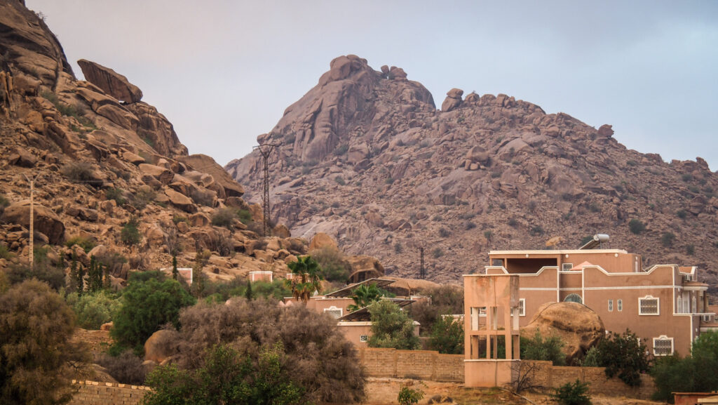
After Morocco gained independence in 1956, Tafraoute became part of the newly unified state. However, it continued to be a relatively isolated and underdeveloped part of the country. In the mid-20th century, many inhabitants of Tafraoute emigrated to urban centres such as Casablanca or abroad, especially to France, for economic opportunities. This has led to a strong Tafraoute diaspora, particularly in Europe. In recent decades, Tafraoute has gained recognition as a tourist destination, known for its stunning landscapes of pink granite mountains, the Ameln Valley, and its traditional Berber culture. Its annual almond blossom festival, held in February or March, celebrates the region’s natural beauty and agricultural heritage.

How to get there?

From Agadir:

By Bus:

Buses, operated by companies like CTM and Supratours, run regularly between Agadir and Tafraoute. This is an affordable and comfortable option, but make sure to check the schedule in advance.

By Grand Taxi:

Shared taxis are available and a faster, but less comfortable, option than the bus. You may have to wait until the taxi fills up with other passengers before departing.

By Rental Car:

Renting a car gives you the most flexibility to explore the beautiful scenery along the way, such as the Anti-Atlas mountains. The drive is scenic but involves winding mountain roads. It’s about 165 km and the drive takes 3 hours.

If you decide to start from Agadir, I recommend using the service of Click’n’Go Car Rental. Amiable guys and easy to contact on WhatsApp. I rented a Renault Clio for the whole month and got a nice price.

From Marrakech:

By Bus:

There are no direct buses from Marrakech to Tafraoute. You’ll need to first take a bus to Agadir (about 3 hours) and then continue from Agadir to Tafraoute by bus or taxi.

By Rental Car:

Driving is the most flexible option. The route takes you through the Anti-Atlas mountains, offering stunning landscapes. The distance is about 380 km and the drive takes about 6 hours.

Tafraoute, Morocco
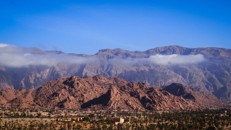
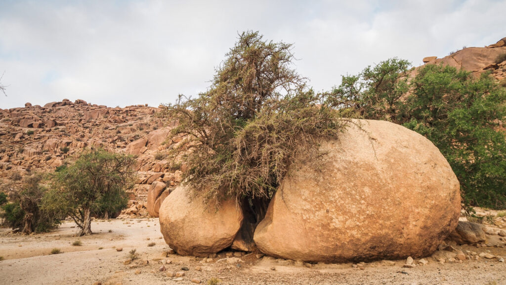
Landscape around Tafraoute

The best time to visit

The best time to visit Tafraoute is between February and April. This period offers mild and pleasant weather with comfortable daytime temperatures, typically ranging from 18°C to 25°C. This is ideal for outdoor activities such as hiking in the Anti-Atlas mountains, exploring the Ait Mansour Gorge, or wandering through the surrounding valleys. Another highlight of visiting Tafraoute during this time is the Almond Blossom Festival when the almond trees in the Ameln Valley are in full bloom. This creates a stunning spectacle of pink and white blossoms, and the festival itself features traditional Berber music, dance, and local crafts.

Tafraoute, like many parts of southern Morocco, can get extremely hot during the summer months, with temperatures often exceeding 40°C in July and August. The heat can make outdoor activities uncomfortable and limit exploration, so it’s best to avoid visiting during this time.

If spring isn’t an option, September to November is another good time to visit. The weather cools down after the summer heat, and temperatures become more pleasant for hiking and sightseeing.

Tafraoute, Morocco
Landscape around Tafraoute

Where to stay?

I stayed in Azur Tafraout. It is located a bit further from the town centre in a very quiet area near the hills but still within walking distance of restaurants. The room was clean and cosy and breakfast provided in the morning was tasty.

How long to stay there?

You can do both, Tafraoute and the drive through Ait Mansour Gorges in one very long day. If you want to include some longer hikes in the area, then a minimum of two days will be needed.

How to get around?

The best is the have a car but if you like walking, then you will be able to see the places around Tafraoute anyway as they aren’t very far from each other. You could even hike to Painted Rocks, although be careful of the weather and you will be crossing desert-like landscapes which can be extremely hot during the day. Get offline Google Maps for that area or even better Mapy.CZ to make sure you won’t get lost.

What to see in Taroudant?

La Maison Berbère Traditionnelle de Tazka

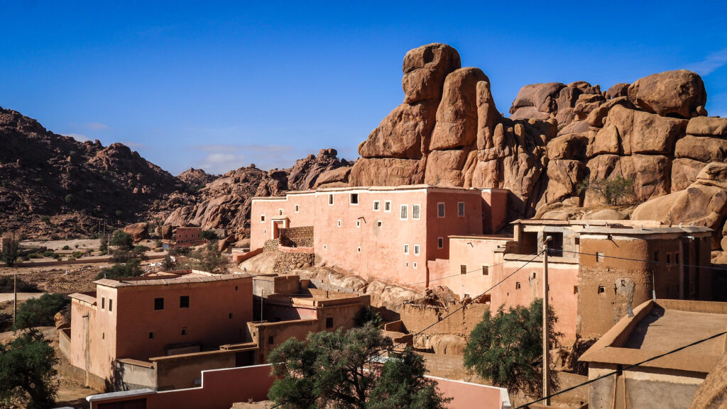
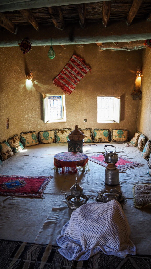
An exciting place where you can learn a lot about the traditional life of the Berbers and see a traditional house with its furnishings. The owner is very nice, and he willingly talks about the current situation in the local community. He also presented old clay pots, tools and the set-up of the house and shared details about how the children studied, where they slept, how they had hammams in the house, how they managed to keep the room steamy, and how the livestock they kept on the ground floor kept the living room and the kitchen warm.

There is a phone number on the door, so if you don’t see anyone around, just give him a call and wait a bit.

Tafraoute, Morocco
La Maison Berbère Traditionnelle de Tazka
Tafraoute, Morocco
The view from La Maison Berbère Traditionnelle de Tazka
Tafraoute, Morocco
The view from La Maison Berbère Traditionnelle de Tazka

Tafraout Valley

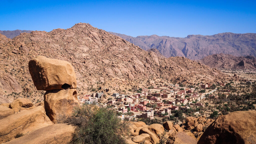
It is a magnificent place with very beautiful rock formations and palm grove walks. Not far from La Maison Berbère Traditionnelle de Tazka, you will find a carved gazelle which is said to be an example of prehistoric rock engravings. I wouldn’t be so sure if it was prehistoric, but anyway, it’s great fun looking for it.

Follow the path further south with the R104 road in the distance on your right. Soon, on the left, you will notice a well-designed path climbing higher up the mountain. At some point, it vanishes but if you do some easy scrambling on the boulders, you will reach a breathtaking viewpoint of the valley.

Tafraoute, Morocco
The viewpoint of Tafraout Valley
Tafraoute, Morocco
The viewpoint of Tafraout Valley

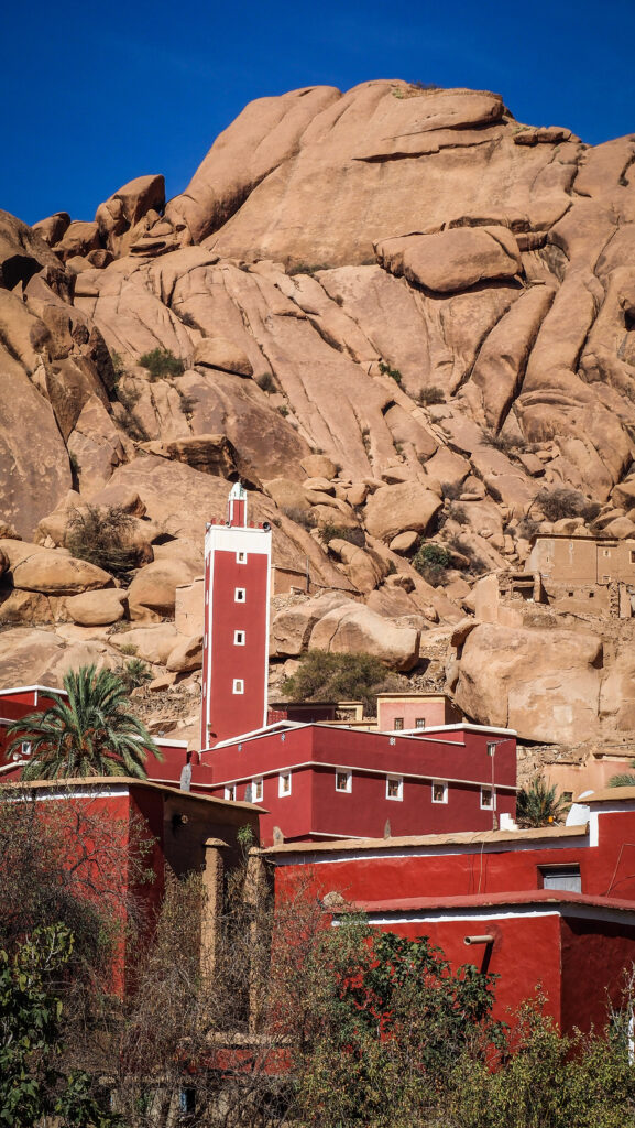
Mosque Aday

A beautiful mosque that contrasts well with the rocky landscape and is surrounded by old traditional houses.

La Maison Touareg

A popular shop which is full of colours and beautiful items, e.g. rugs, jewellery etc. The owner can get you anything that you need and is a wonderful person who doesn’t push you to buy anything.

Finger Mountains / Napoleon’s Hat

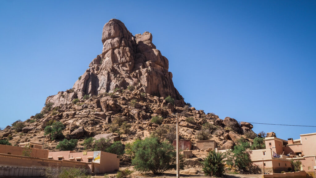
The iconic rock formation is named after its resemblance to the famous Napoleon’s hat. Let’s just say the resemblance is a bit far-fetched.

Tafraoute, Morocco
Napoleon’s Hat

Painted Rocks

Belgian artist Jean Verame created the painted rocks in Tafraoute. The installation lasted three months and required an amazing 18 tonnes of paint.

They are generally known as blue rocks, however they are actually multicoloured. Pink, red, black, yellow, and orange are also present among the blues. Naturally, because the rocks were so exposed, the paint weathered significantly over time. However, they have now been repainted to restore their original vibrancy.

The access road is mostly gravel but suitable for 2WD cars.

Tafraoute, Morocco
Painted Rocks
Tafraoute, Morocco
Painted Rocks

Ait Mansour Gorges

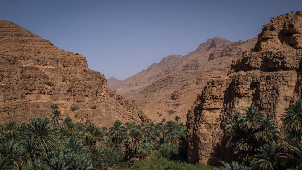
The Ait Mansour Gorges is a stunning natural feature located near Tafraoute in southern Morocco’s Anti-Atlas mountains. Known for their dramatic rock formations and lush palm groves, the gorges offer a striking contrast between the barren, arid mountains and the greenery of the oasis within them.

Ait Mansour is relatively remote, making it a peaceful and less touristy destination compared to other Moroccan attractions. It is located about 30 km southeast of Tafraoute.

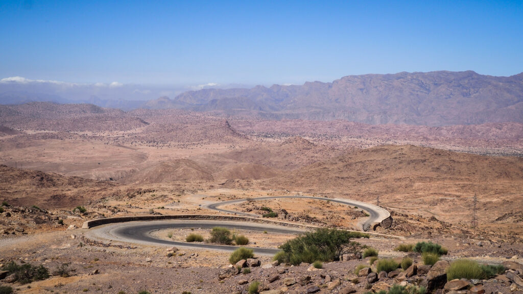
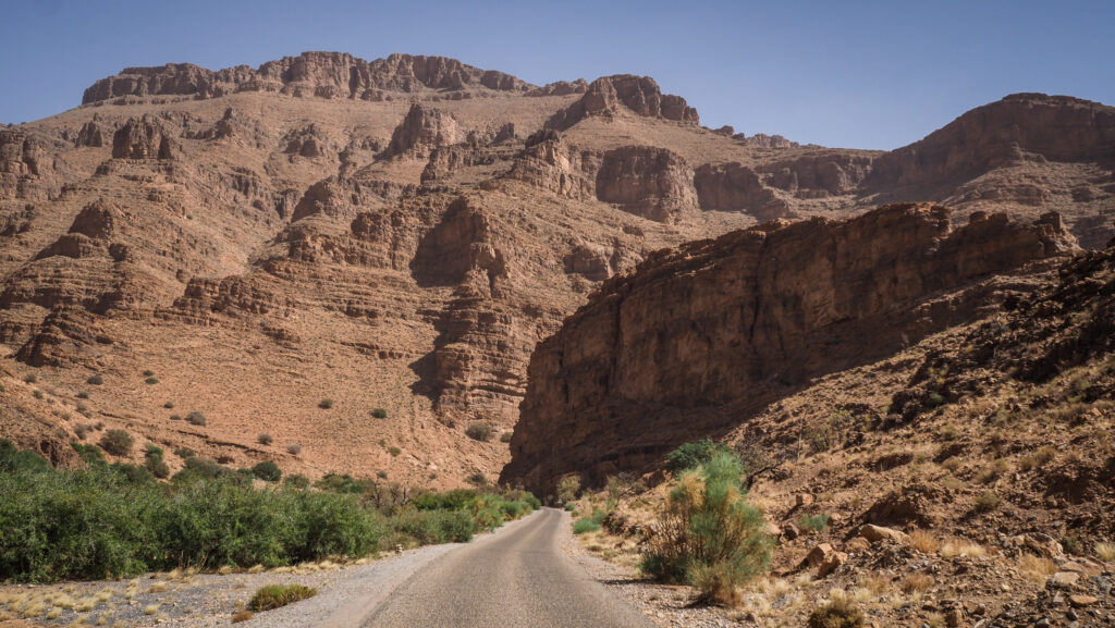
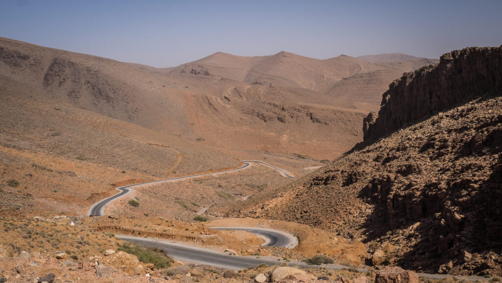
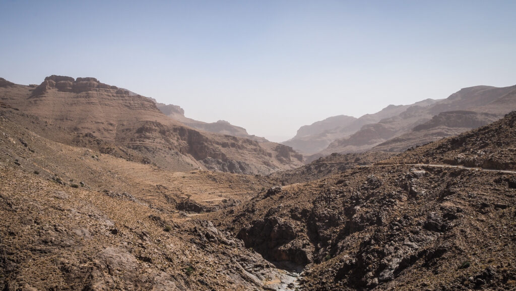
I followed the road R107 and just before the Painted Rocks, I took a left turn towards Ait Mansour. The road was very winding but there was minimal traffic so the driving experience was relaxing. With every kilometre, the views were becoming even more spectacular. The gorges are characterized by towering red and pink granite cliffs that rise dramatically on either side of a winding valley. The landscape is a mix of rocky terrain and lush vegetation, with palm trees, olive groves, and small agricultural plots fed by natural springs.

Ait Mansour, Morocco
The winding road is climbing higher and higher

I made a quick stop in Ait Mansour to drink a coffee and have a walk among palms. The oasis is watered by a river that runs through the gorges, providing a life-giving resource to the otherwise dry landscape.

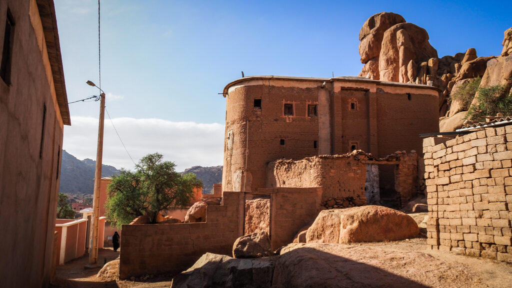
The area around the Ait Mansour Gorges is home to traditional Amazigh (Berber) communities. Small villages are scattered throughout the gorge, where locals live in mud-brick houses and practice subsistence farming.

Ait Mansour, Morocco
The oasis in the valley looks amazing
Ait Mansour, Morocco
Driving through Ait Mansour

From Ait Mansour I continued the drive towards Gdour and then I turned right to continue the loop through Ait Bou Nouh and Ait Ou Said and in the end connecting again with the road R107. It was easily one of the best drives that I have done in Morocco!
The entire loop is about 100 km long and the drive takes 3 hours. Don’t rush it though! You will want to make plenty of stops!
Ait Mansour, Morocco
Driving through Ait Mansour Gorges
Ait Mansour, Morocco
Scenic road continues
Ait Mansour, Morocco
Scenic road continues

Hermannsburg

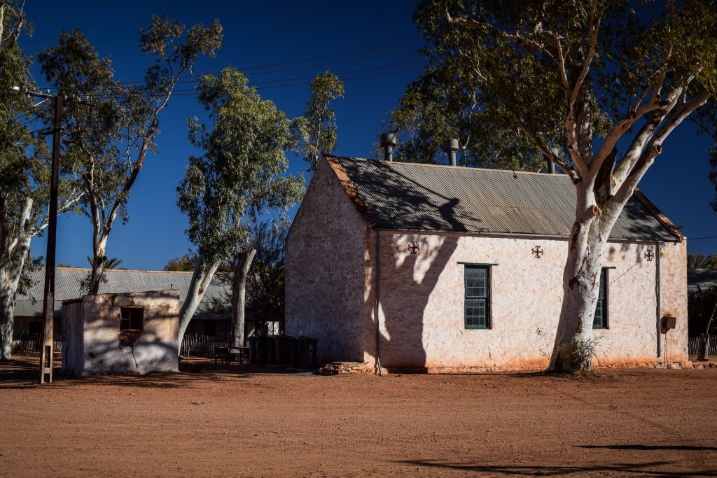
This Aboriginal community is on the way to Palm Valley, therefore its historic precinct is very often visited by organized groups on day tours. It was established in the 1880s as a Lutheran mission by German pastors, hence its name. They constructed characteristical buildings including a church, school and several houses. Today, you can enjoy your time in a tea shop, museum and the Namatjira Gallery.

Albert Namatjira is a world-famous Aboriginal watercolor artist born in Hermannsburg. Due to his art, he gained an appreciation and became the first Aboriginal person to get restricted Australian citizenship allowing him to vote, buy alcohol and claim land rights. In 1953 Namatjira was awarded the Queen’s Coronation Medal and in 1968 he was honored on an Australian postage stamp.

You can admire his works in many museums all around Australia and don’t forget to check the ones in the museum in Hermannsburg Historic Precinct.

Hermannsburg
Lutheran mission buildings
Hermannsburg
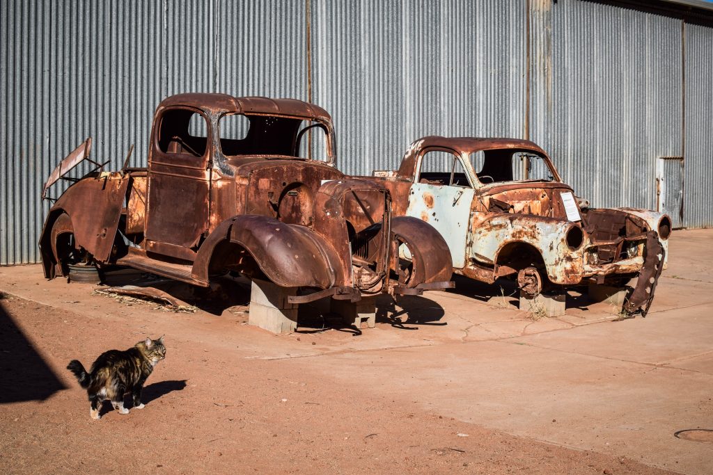
Old cars from Lutheran mission times
Hermannsburg
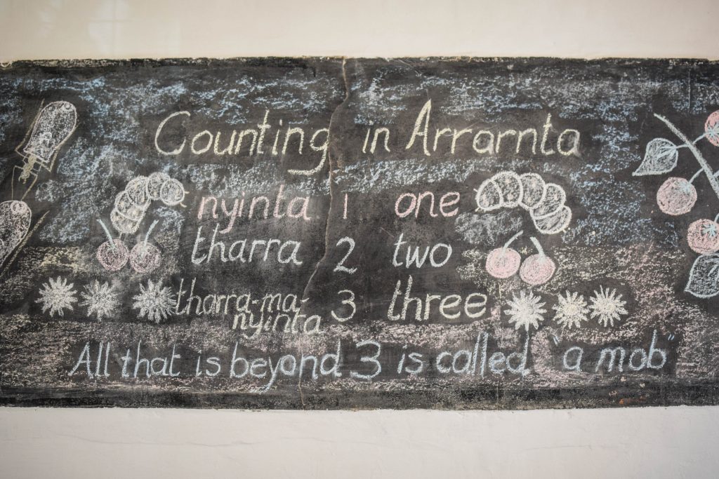
School building in Historic Precinct

Palm Valley

Palm Valley lies within Finke Gorge National Park that covers an area of around 46.000 hectares in Central Australia. Why is it so special? Because it’s like an oasis filled with around 12.000 Red Cabbage Palms after which the valley is named. There is no other place like that in the region and the nearest specimens are 850 km away in Queensland.

Why are there palms on the desert?

One of the very first versions claimed that palms are survivors from prehistoric times when the climate in this region was far more tropical. However, recent studies proved that the same species of palms grow around 1000 north around Mataranka and Katherine. It is believed that the seeds were transported from one place to another by migrating people 15.000 – 30.000 years ago. Why did they move? That remains uncertain and we can only speculate: the rise of sea levels, bushfires, etc.

The theory would, in fact, go in line with Aboriginal legend telling about palm seed brought by the ‘gods form the north’. Is it really possible that the legend survives more than 15.000 years? I don’t know but I like to believe it is. It only adds magical feeling to this already extraordinary place.

While Red Cabbage Palms are the main actors in this theatre, there are about 684 species of plants living in Finke Gorge National Park, 30 of them being rare and 16 that can be found only here.

Northern Territory, Australia
The Amphitheatre

How to get there?

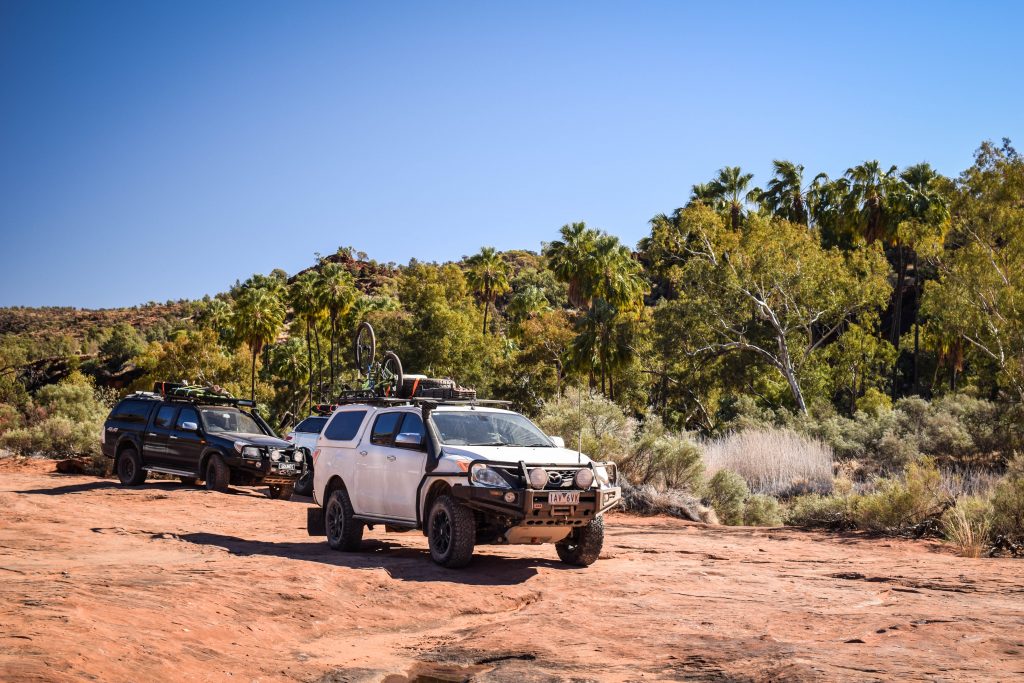
You would need 4WD and I mean it. In many parts of Australia, I managed to access remote attractions with 2WD, just taking it easy and driving on corrugated dirt with care. But here, it certainly wouldn’t be possible. You will drive on a sandy bad of Finke River after all!

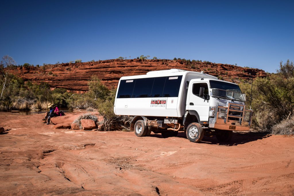
Therefore, without high clearance 4WD, I would suggest going for an organized tour as I did. It was a totally hassle-free experience in a 4WD truck and commentary provided by our guide Bluey from Emu Run Experience was probably the biggest advantage! Daily tours depart from Alice Springs and from there it takes around 2 hours to get to the national park. Besides Finke River National Park, they usually stop at Hermannsburg as well.

Northern Territory, Australia
The truck from Emu Run Experience tour operator

On the way back we saw 4WD Toyota Hilux in trouble when the driver went too fast and broke suspension which in the result made a puncture in the fuel tank. The fuel leaked out completely in just a few seconds and that was the end of the trip for unlucky ones. Other tourists gave them a lift to Alice Springs where they had to find a mechanic and spare parts and then come back to Palm Valley to fix the car onsite. Difficult Aussie life!

Northern Territory, Australia
Well prepared 4WD vehicles are essential to access Palm Valley

Overnight

If you travel independently you may want to set your camp at the dedicated spot and spend a night in this remote area. It must be an amazing experience and I would certainly do so next time. There are showers, toilets and barbecues provided. Don’t forget to take some cash to pay onsite.

Northern Territory, Australia

Walks in the area

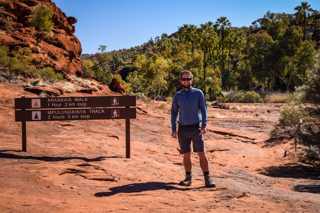
Arankaia Walk (2 km, 1-hour return) – located in Palm Valley itself it gives you the best opportunity to admire these spectacular plants.

Mpulungkinya Walk (5km, 2-hours return) – the longer version of Arankaia Walk.

Kalarranga Lookout (1.5 km, 45 min return) – easy ascent to the top where I was rewarded by the panoramic view of the national park and surrounding amphitheater of rocks. It’s a breathtaking spot for sunset, so if you camp overnight, get here on time!

Mpaara Walk (5 km, 2 hours return) – it’s a nice walk but also cultural experience describing the mythology of Western Aranda Aboriginal people. The start is at Kalarranga parking.

Northern Territory, Australia
Trailhead of Arankaia and Mpulungkinya tracks
Northern Territory, Australia
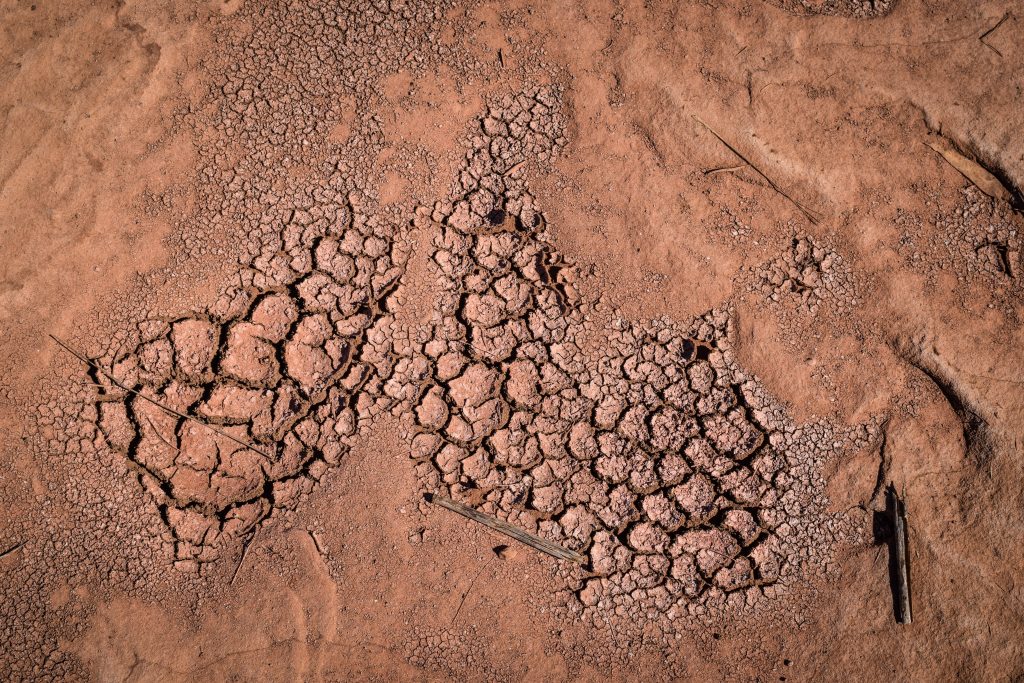
The arid ground in Palm Valley

A few things to remember

Please don’t ignore the guidance provided by Finke River National Park:

  • Camping is only permitted in the designated camping areas at Palm Valley and along the Finke River at Boggy Hole.
  • Collect firewood before entering the park.
  • At Palm Valley, fires are only permitted in designated fire pits.
  • Pets are not permitted in the National Park.
  • Rubbish bins are not provided, so take your rubbish with you.
  • If traveling the Finke River 4WD route, stay on the marked track.
  • Be careful where you walk and stay on the marked tracks. Young palms can be destroyed by visitors not realizing what they are walking on. The regeneration of the palms is needed for the survival of this population.

Enjoy this beautiful place!

Making use of cheap flights from Warsaw to Amman and a couple of free days between Christmas, New Year and Epiphany, I decided to visit the country that is home to spectacular sights such as Petra and Wadi Rum. Jordan has also the opinion of being the safest country in a rather unstable region. Travelling through Jordan in winter is a good idea for those that prefer cooler temperatures. It’s quite pleasant around the Dead Sea and the Red Sea, but the desert can get really cold and snowfall is possible. Furthermore, some attractions won’t be available due to the risk of flash floods, e.g. canyon hikes.

The following itinerary assumes you rent a car for the entire duration of your stay which makes moving between sights much easier and faster.

Day 1 – Amman airport, Bethany Beyond the Jordan, the Dead Sea

Upon arrival in Amman, you will meet a representative of Monte Carlo Car Rental company. They will take you to their office which is only 10 minutes from the airport, where you will pick up the keys to your car. In my case, it was a Mitsubishi Mirage. It’s a small car but should fit perfectly for 1-2 travellers or even 3 if travelling light.

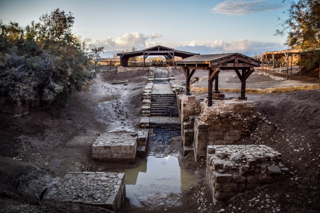
From there, take a very picturesque road descending the hills towards the Dead Sea, passing by the area where people live in tents and walk with the goats. Soon you will arrive at Bethany Beyond the Jordan. Several archaeological excavations in that area uncovered remains of churches, baptismal pools and prayer halls. Today, it is believed to be the most likely site of the baptism of Jesus by John the Baptist. Of course, it’s kind of symbolic, as the exact spot will probably never be identified. Entrance costs 12 JOD and sightseeing is with guided tours only which include transfer from the parking to the baptism site by minibus. The last entry in the wintertime at 4 pm and in the summertime at 6 pm.

Overnight: Ramada Resort by Wyndham Dead Sea. The hotel has its own beach and is very affordable comparing to other hotels and resorts in the area of Dead Sea.

Monte Carlo Car Rental, Jordan
Small but fast! Rented MItshubishi Mirage from Monte Carlo Car Rental
Bethany Beyond Jordan
Baptism site, Bethany Beyond Jordan
Bethany Beyond Jordan
Jordan
En route from Amman to Bethany Beyond Jordan
Jordan, Middle East
En route from Amman to Bethany Beyond Jordan

Day 2 – Dead Sea Highway, Wadi Mujib, Karak Castle, arrival to Wadi Rum

After breakfast, check out the beach that belongs to the hotel. It’s only 10 minutes walk or alternatively you can use a shuttle bus. When I was there, the weather was pretty bad. Cloudy, windy, cold. There was a blue sky on the horizon so probably later the situation improved but at that moment I really didn’t feel like going to the water. Instead, I hit the road towards Karak Castle with several stops on the way.

The Dead Sea, Jordan
Beach at Ramada Hotel

First stop is Wadi Mujib. It’s a very popular canyon for hikes, however, in winter it’s closed due to the risk of flash floods. The information centre and viewpoint there is still open though, so it’s worth to have a look.  

Wadi Mujib, Jordan
Wadi Mujib

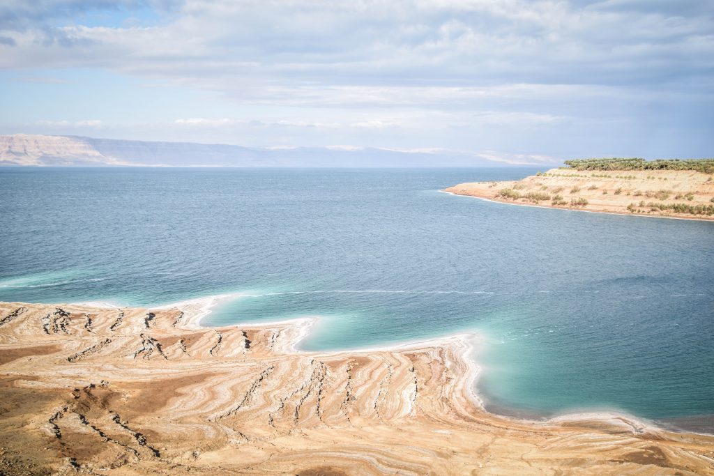
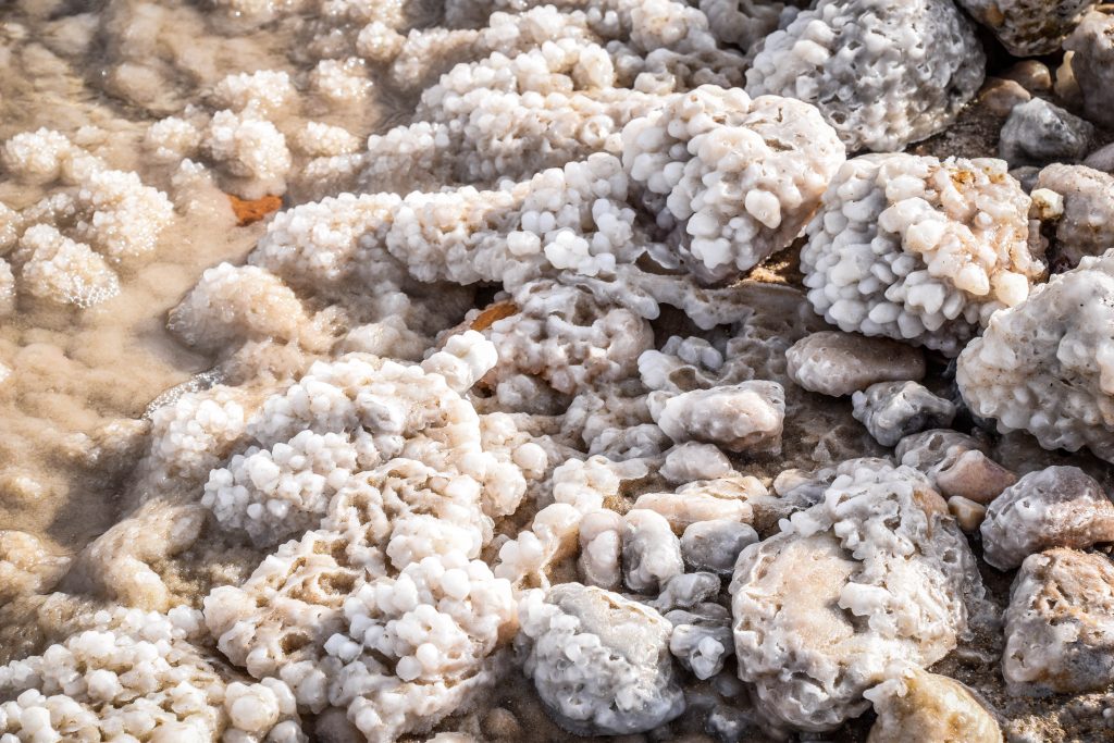
Continue along Jordan Hwy towards the place called Coral Reefs. The name comes from the salt formations on the banks of the Dead Sea, which looks similar to the coral reef. Leave the car just off the main road, take your swimming shorts and shoes (essential as the salt crystals are very sharp) and make your way down the hill. Being away from the main paid beaches, it’s a great place for a peaceful play in the Dead Sea. The water was much warmer than I expected and the feeling of floating was stunning!

The Dead Sea, Jordan

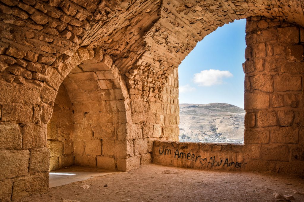
Next, take Route 50 towards Karak Castle. It’s one of the largest and most famous Crusader castles in the region where furious battles between Crusaders and Islamic armies of Saladin took place.

Karak Castle, Jordan

From Kerak it’s about 3.5 hours drive via Kings Hwy to Rum Village. Whichever Bedouin camp you choose, it’s necessary to park the car here, find your company representative and continue further to the camp by 4×4 jeep. I chose Bedouin Directions, which have a camp about 45 minutes drive from the village into the desert. Contact them online to check availability.

Overnight: Bedouins Directions campsite

Day 3 – Wadi Rum

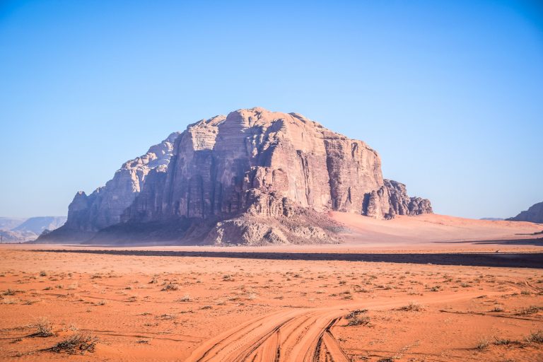
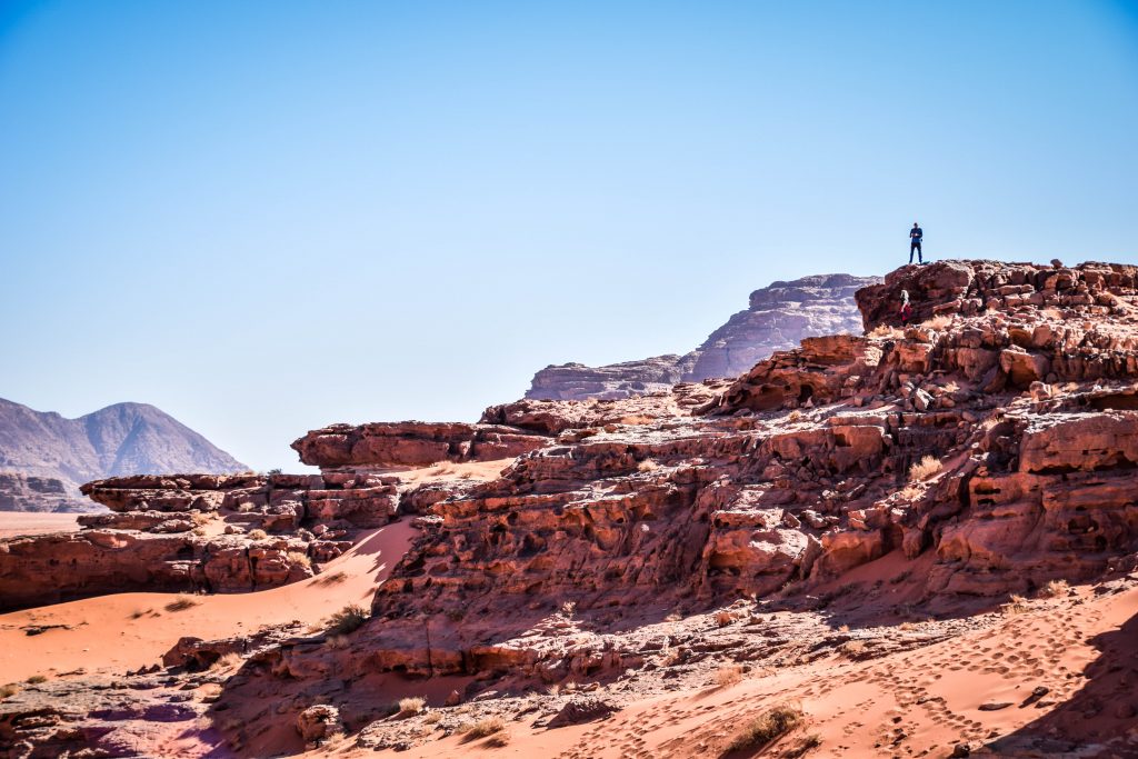
You have several options about how to spend the day. Hiking, camel trekking or jeep tours being the most popular ones. I opted for the full-day jeep tour. The guide and driver from Bedouin Directions was a great guy, even though his English skills were very limited. During the tour, you will visit several highlights of the desert: Lawrence Spring, Red Sand Dune, Little Rock Bridge, Burdah Rock Bridge, Um Fruth rock bridge, Khazali & Burrah Canyons. Everything concluded with an amazing sunset!

Wadi Rum, Jordan
Wadi Rum, Jordan
Wadi Rum, Jordan
Wadi Rum, Jordan
Wadi Rum, Jordan
Wadi Rum, Jordan

Overnight: Bedouins Directions campsite

Day 4 – Wadi Rum, Aqaba

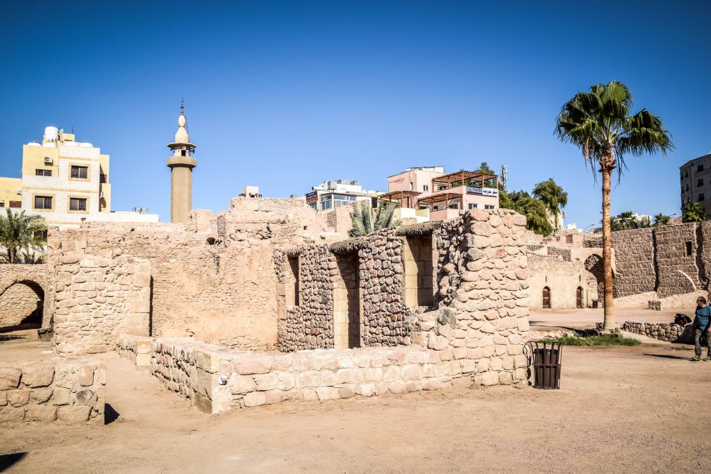
In the morning, do 1-hour camel ride back to the Rum Village and then stop at the Visitor Centre for a short hike from there towards The Pillars of Wisdom. How difficult it is to walk on soft sand! In the second half of the day, make your way to Aqaba. There, visit the castle built by Crusaders, Sharif Hussein bin Ali Mosque and South Beach known for great snorkelling and diving. Corals are really nice, there is also the wreck of the plane and tank accessible even for snorkelers. Several dive centres operate in the area so rent your gear and ask for directions over there.

Aqaba, Jordan
Aqaba Castle
Aqaba, Jordan
Sharif Hussein bin Ali Mosque, Aqaba
Aqaba, Jordan
Aqaba

Overnight: Grannie House

Day 5 – Little Petra, Petra

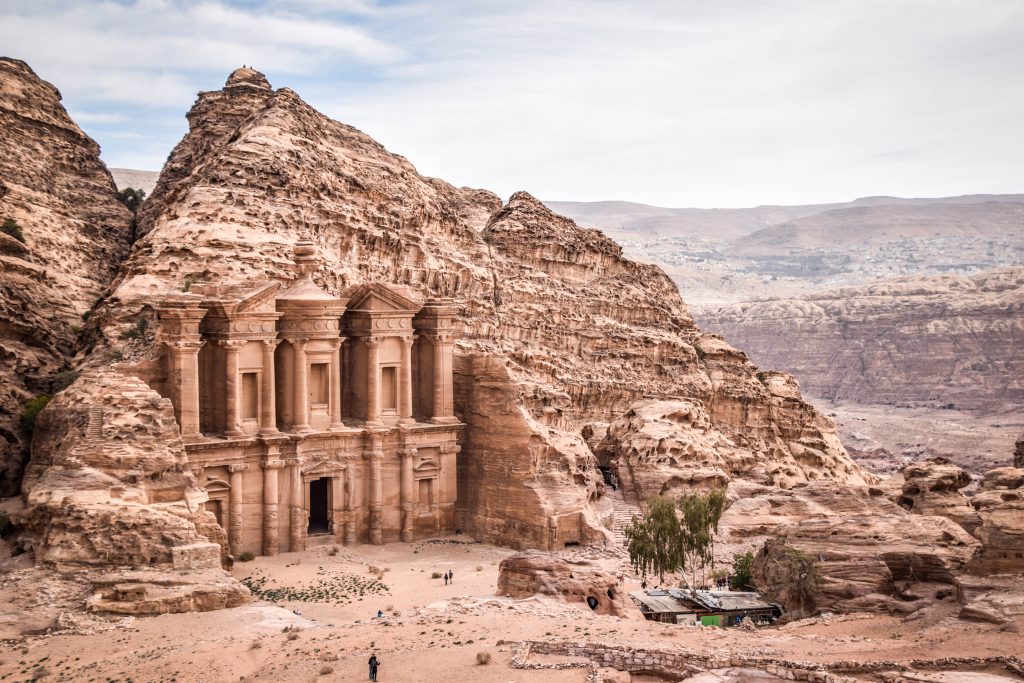
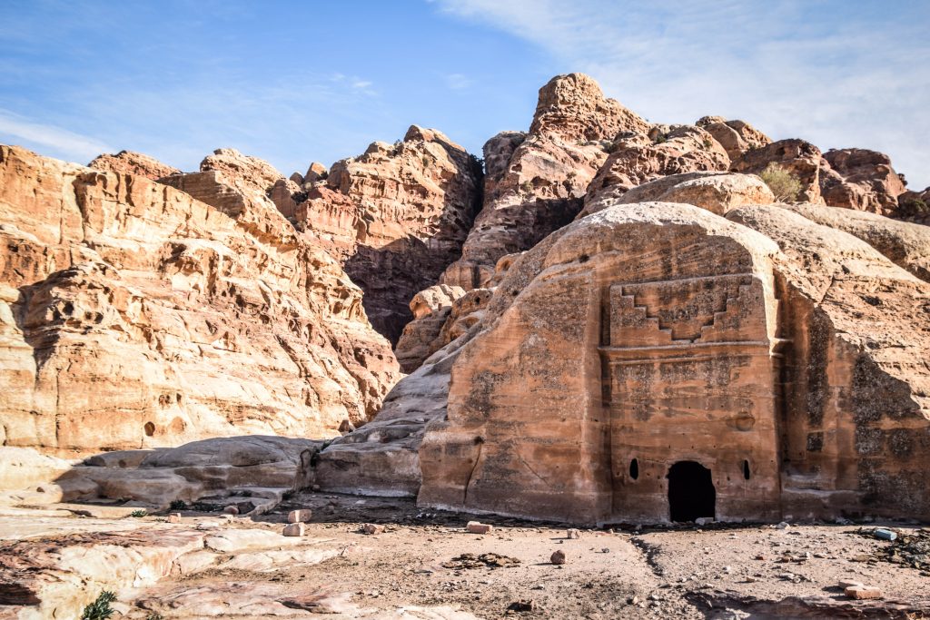
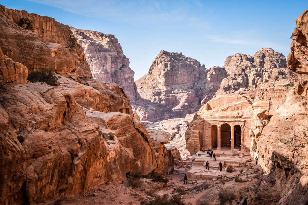
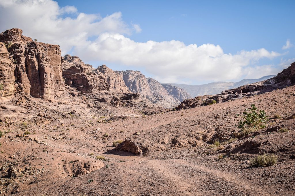
Follow Route 65 to the north until after around 1.5 hours you will see the signs towards Petra. Turn right and continue along the mountain road to the intersection with Kings Hwy. Little Petra should be your first stop. If you do Little Petra after main Petra, then it simply won’t impress you that much. Continue to one of the New Seven Wonders of the World – Petra and have a look into Petra Museum first to get the historical background of what you will see later. Then, continue through the Siq to the High Place of Sacrifice and further through Wadi Farasa exiting right next to Temple of Dushares. It’s a great hike and not that busy as the main road in Petra. It’s getting late so start to walk back, stopping next to the Royal Tombs to admire the sunset.

Petra, Jordan
Ad Deir, Petra
Petra, Jordan
Petra
Petra, Jordan
Treasury, Petra
Petra, Jordan
Wadi Farasa Trail, Petra
Petra, Jordan
Wadi Farasa Trail, Petra

I was considering doing the attraction called Petra by Night, but after reading so many negative reviews I decided not to. If you decide to do it, it’s every Monday, Wednesday and Thursday of each week and costs 17 JOD.

Overnight: Nomads Hostel

Day 6 – Petra, Shobak Castle, Dana Village

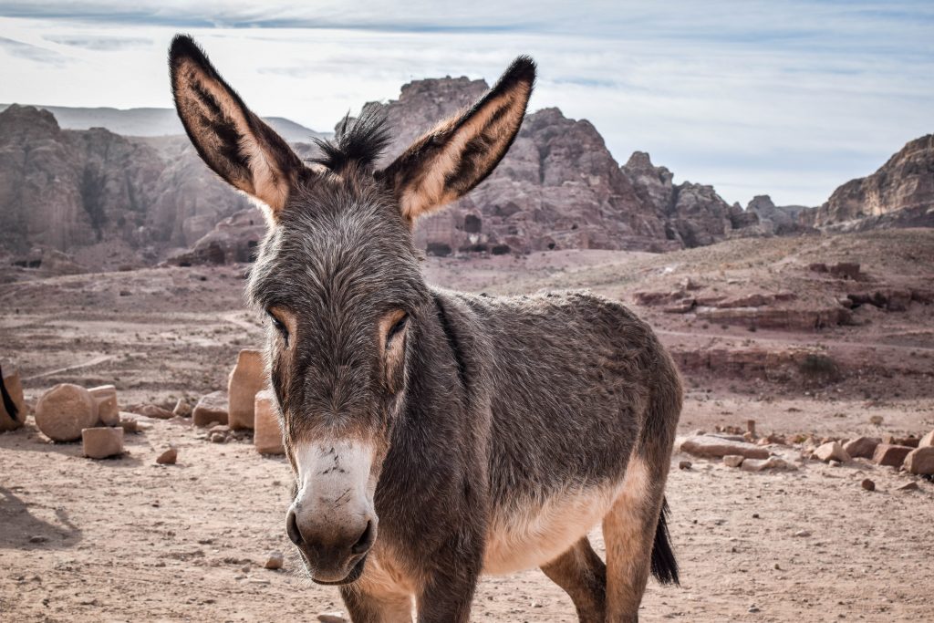
Start the day at 6 am to have the chance of taking a couple of pictures in the Siq without crowds. Next, climb the rock just opposite the Treasury and then follow Al-Khubtha Trail (starting just to the left behind the Royal Tombs) to another Treasury Viewpoint. The next stop is Ad Deir (Monastery) and you will get there following the uphill trail to the end of the valley with lots of donkey poo on it. On the way back, I check out the Great Temple, Lion Triclinium, Roman Theatre and Byzantine Church. Finally, it’s time to hit the road again. Make your way to the next destination – Shobak Castle.

Petra, Jordan
Petra
Petra, Jordan
Petra

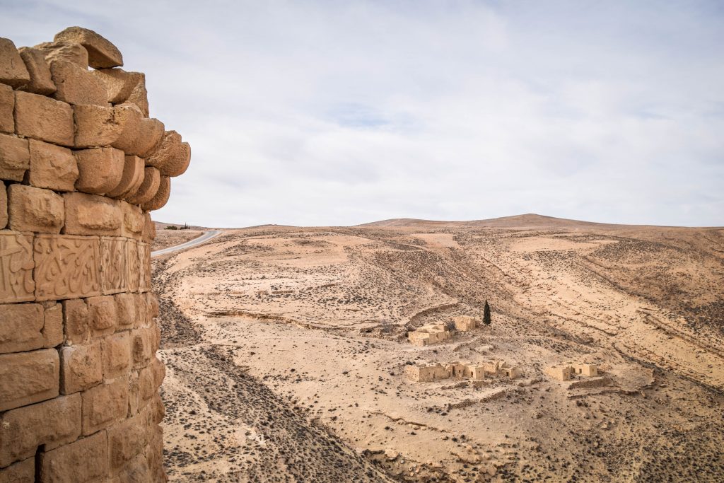
Shobak Castle is a Crusader castle built by the king Baldwin I in 1115. The location on the hill and landscape around it are more interesting than the castle itself, although it’s still interesting to wonder around such old walls. Defenders of the castle resisted numerous attacks from the armies of Saladin before giving up after an 18-month siege. From here, your hotel in Dana Village is only half an hour away.

Shobak Castle
Landscape around Shobak Castle
Shobak Castle
Shobak Castle panorama
Shobak Castle
View from Shobak Castle
Dana, Jordan
Dana Reserve

Overnight: Dana Tower Hotel. I recommend paying extra for dinner. It doesn’t seem that there is a lot of restaurants beside ones in hotels, and the buffet in Dana Tower Hotel is great value for the price.

Day 7 – Wadi Dana Trail

The guys in Dana Tower Hotel advised me to start the hike early as later on there is someone standing at the entrance and charging 8 JD. I recommend to do the same! The trail is 16 km long and starts just behind the hotel. It is not marked, however, it would be really difficult to get lost as you follow the valley all the time. You can either go to the end, where you will reach Feynan Eco-Lodge and organize a taxi back to Dana Village. A taxi will cost around 40-50 JD and take over 2 hours. You can get a drink in Feynan and wait for more hikers to split the costs. Alternatively, simply don’t go to the very end of the trail and come back the same way on foot. The landscape does not change anyway and you will save quite some money. The whole adventure takes most of the day and Dana Village is pleasant enough to justify another night there.

Dana, Jordan
Dana Trail
Dana, Jordan
Dana Trail
Dana, Jordan
Dana Trail
Dana, Jordan
Dana Village

Overnight: Dana Tower Hotel

Day 8 – Lot’s Cave, Umm ar-Rasas, Fortress of Machaerus, Madaba

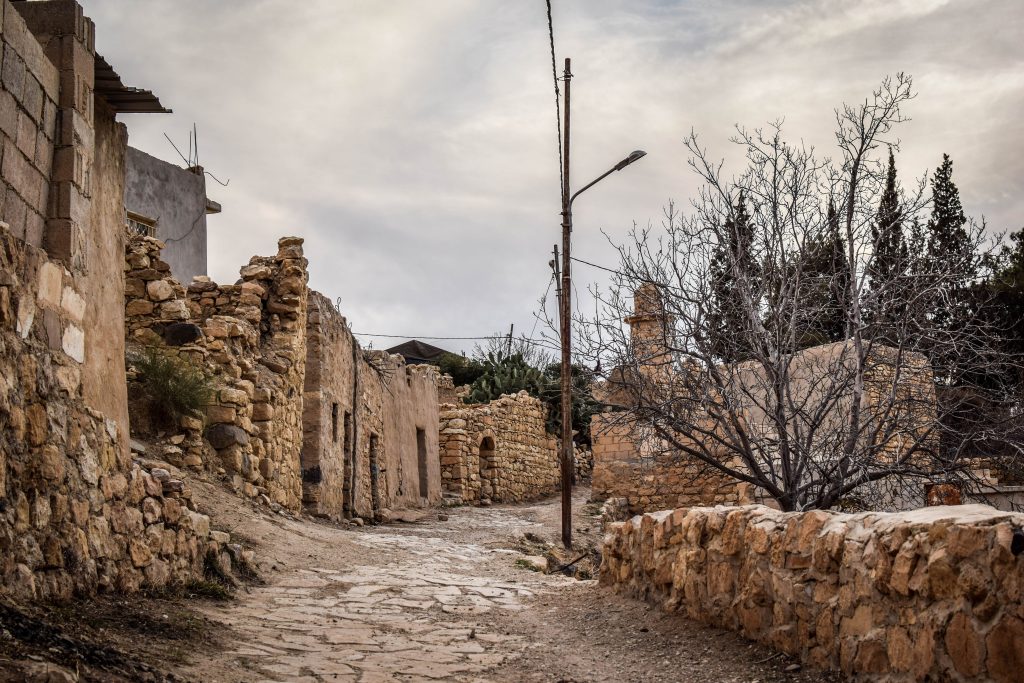
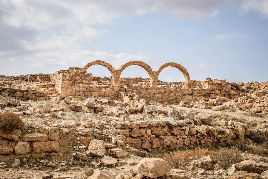
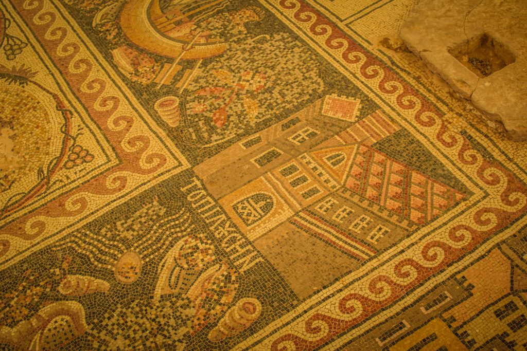
Long drives today. First, make a detour to Lot’s Cave. Lot is believed to have lived here together with his daughters after fleeing the destruction of Sodom and Gomorrah. Next stop is Umm ar-Rasas ruins with famous floor mosaic in Stephen’s Church.

Umm Ar Rasas, Jordan
Umm ar-Rasas
Umm Ar Rasas, Jordan
Umm ar-Rasas
Umm Ar Rasas, Jordan
Umm ar-Rasas

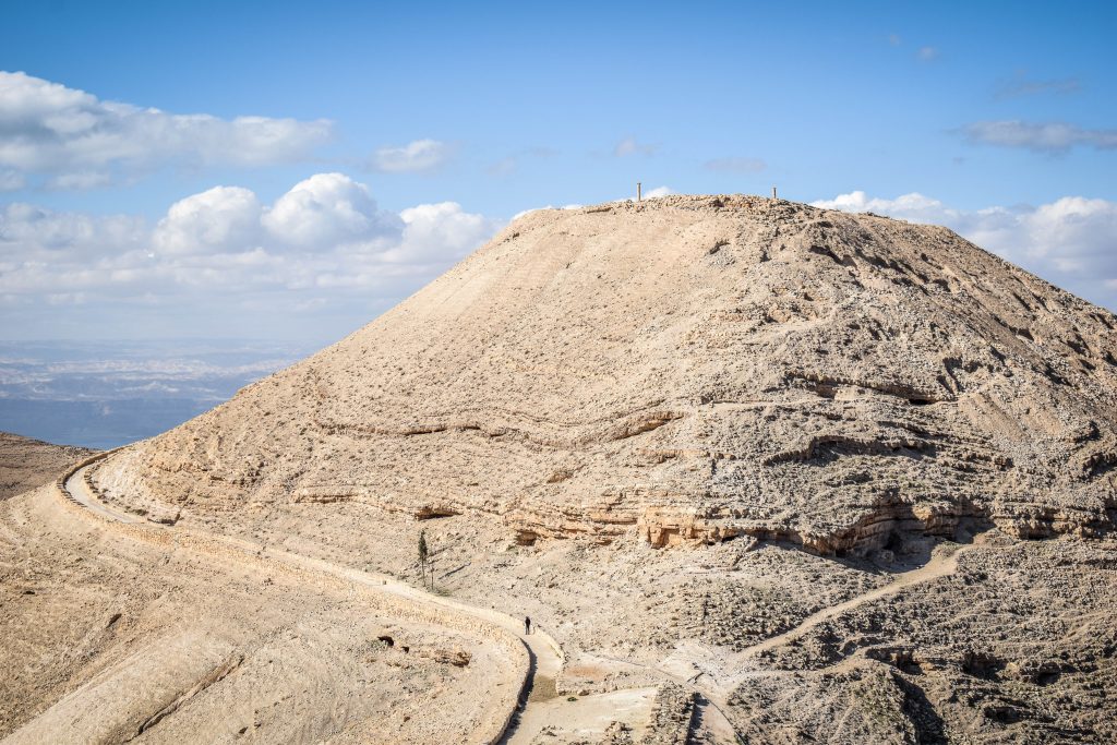
Further on the Fortress of Machaerus offers breathtaking views of the Dead Sea and the surrounding area. The place is most likely where John the Baptist was kept captive and eventually beheaded. Not much of the ruins left though.

Machaerus, Jordan
Machaerus Fortress

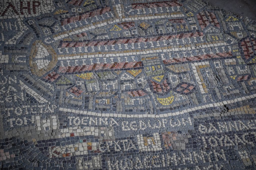
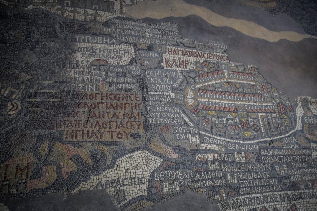
Continue to Madaba – the city of mosaics. The most famous one is in St George’s Church and presents the map of all major biblical sites in the Middle East, including Egypt and Palestine. But it’s certainly not the only site worth visiting in town. Church of the Beheading of John the Baptist offers superb city panorama from its bell tower but also photographs and replica of mosaic at Umm ar-Rasas. Not enough of mosaics? Then drop by to Church of the Apostles, Archeological Parks I & II and Madaba Museum.

Madaba, Jordan
View from the Church of the Beheading of John the Baptist
Madaba, Jordan
Madaba Map, St George’s Church
Madaba, Jordan
Madaba Map, St George’s Church
Madaba, Jordan
Madaba Map, St George’s Church

Overnight: Moab Land Hotel

Day 9 – Amman

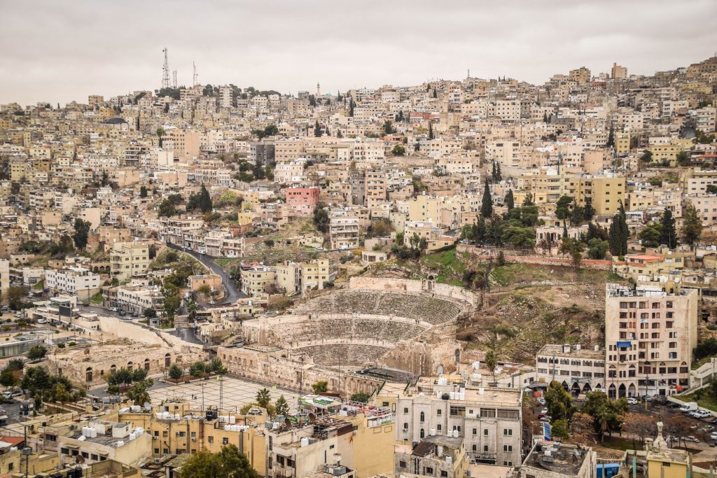
One day is an absolute minimum to do the city justice. The ruins of Citadel on top of Jebel Al Qala and Roman Theatre (seating capacity 6.000) downtown are must-see. Getting a ticket to the last one will also get you into the Folklore Museum and Museum of Popular Traditions. Both are very compact but worth having a quick look. Odeon is just on the east side of the Roman Theatre. Back then it was a place for music performances and seated 500 people. A few steps further are Al Husseiny Mosque and Nymphaeum (public fountain).

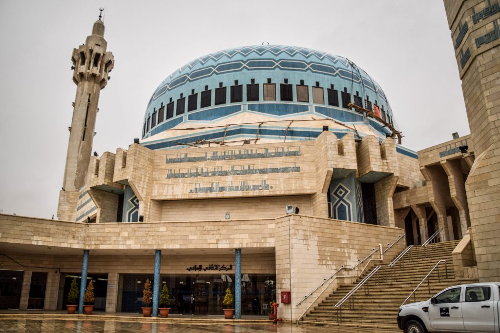
Drive or take a taxi to King Abdullah Mosque. It was finished in 1989 and is recognizable by a huge blue dome. Tourists are welcome to visit.

Add to your day Jordan Museum which is the best in the country and leads you through Jordan’s history from ancient to modern times.

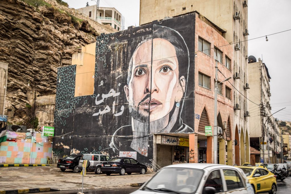
Putting all the historical attractions on the side, in this city, you will get something that you can’t get anywhere else in Jordan. It’s big, dynamic and modern with a lot of nice eateries, coffee houses and cool hostels. For dinner and drinks check out Rainbow Street or Hashem Restaurant for their famous falafel and hummus. I was there twice!

Amman, Jordan
View from Citadel, Amman
Amman, Jordan
Roman Theatre, Amman
Amman, Jordan
Roman Theatre, Amman
Amman, Jordan
Citadel, Amman
Amman, Jordan
Citadel, Amman
Amman, Jordan
Streets of Amman
Amman, Jordan
Streets of Amman
Amman, Jordan
King Abdullah Mosque

Overnight: Sydney Hotel

Day 10 – Jerash, As-Salt

Start the day with a drive to Ajloun Castle, which was built in the 12th century under the rule of the sultan and military leader Saladin. The castle sits on top of Mount ‘Auf and provides visitors with panoramic views of the Jordan Valley and surrounding desert. 

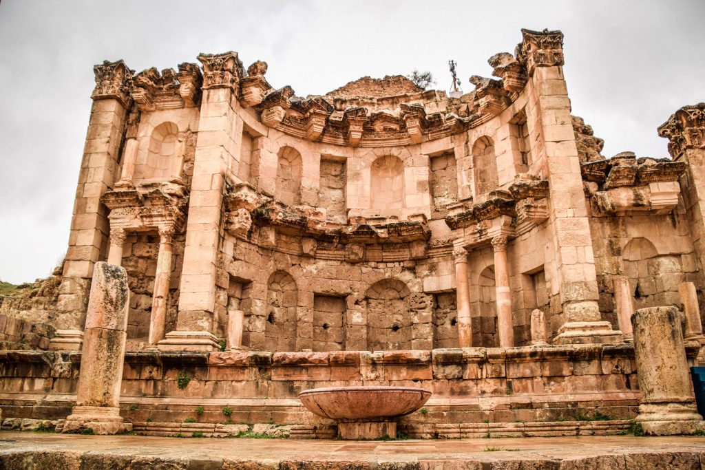
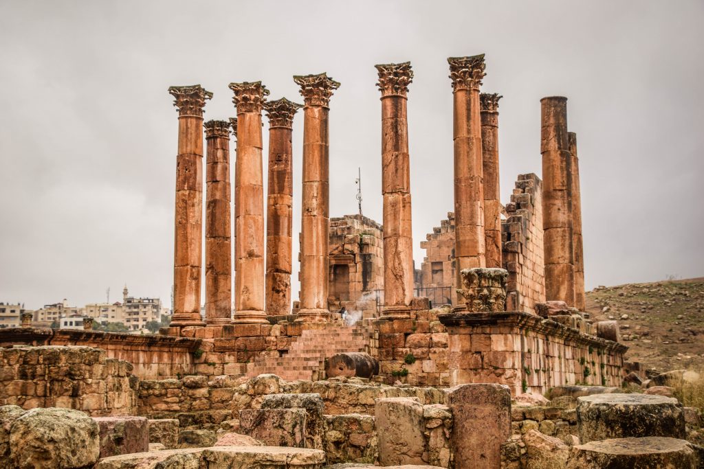
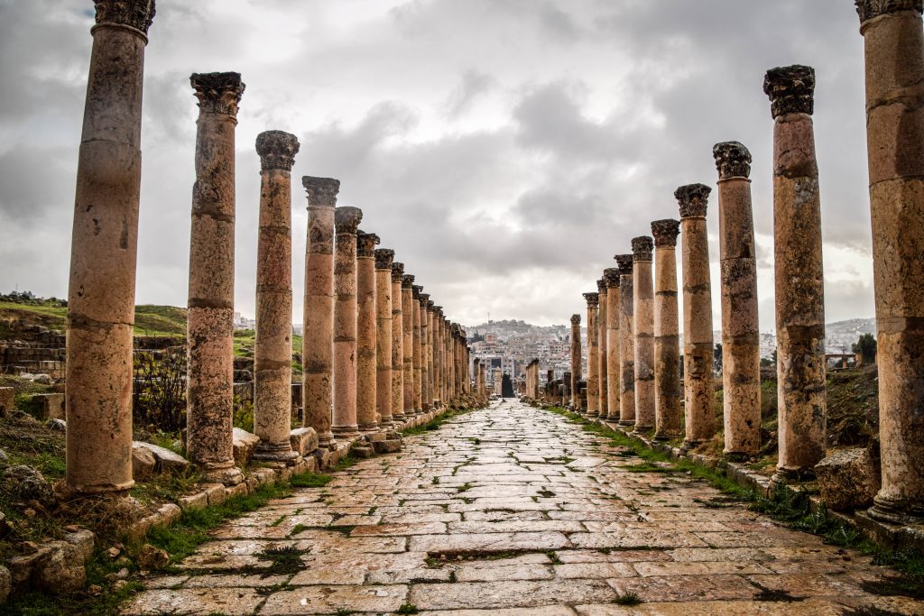
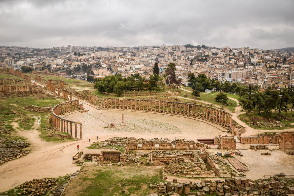
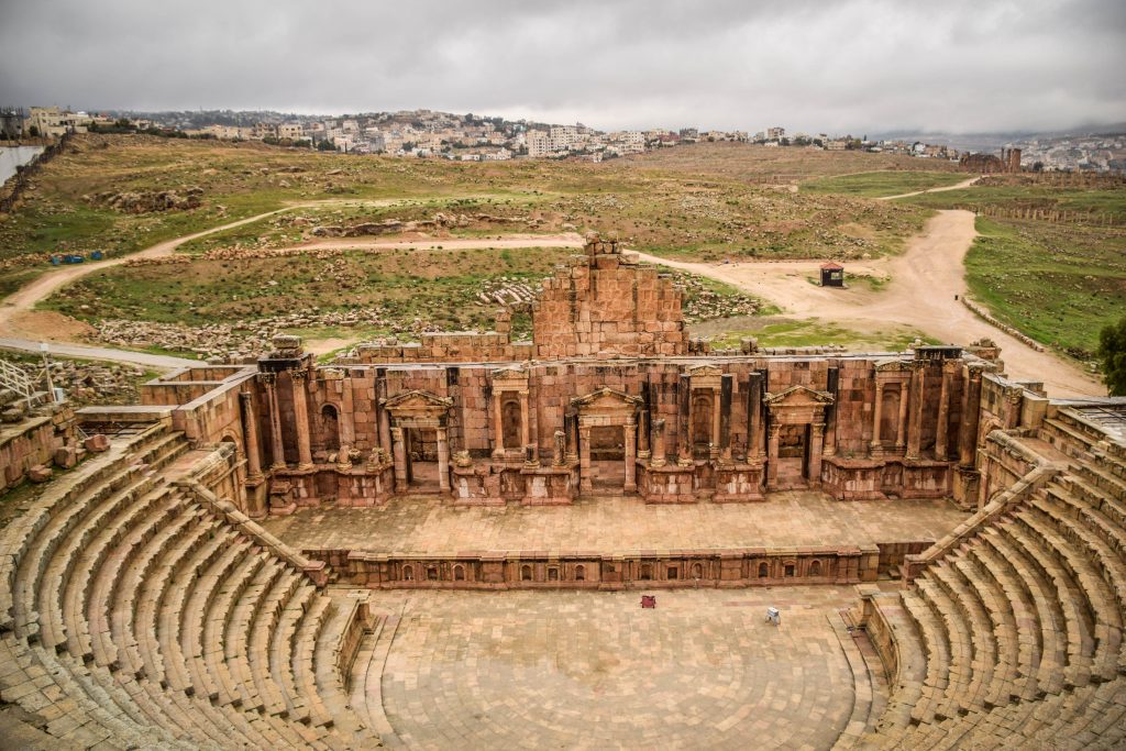
Next, return to Jerash. Tourists stop here for one reason – Roman ruins of the ancient city in Archeological Site of Jerash. Enter through Hadrian’s Gate and get lost in this big area with ceremonial gates, collonaded streets, hippodrome, forum, theatres, temples, fountains and a small museum. At least 3 hours are necessary to see and appreciate it all.

Jerash, Jordan
Nymphaeum, Jerash
Jerash, Jordan
North Gate, Jerash
Jerash, Jordan
Temple of Zeus, Jerash
Jerash, Jordan
North Theatre, Jerash
Jerash, Jordan
Collonaded Street, Jerash
Jerash, Jordan
Forum, Jerash
Jerash, Jordan
South Theatre, Jerash

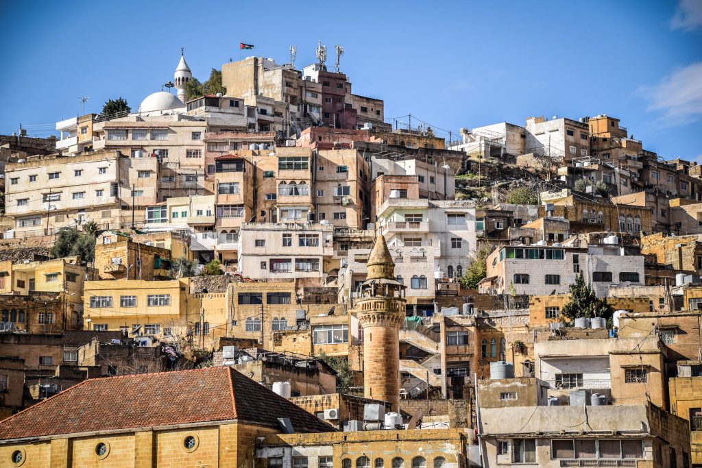
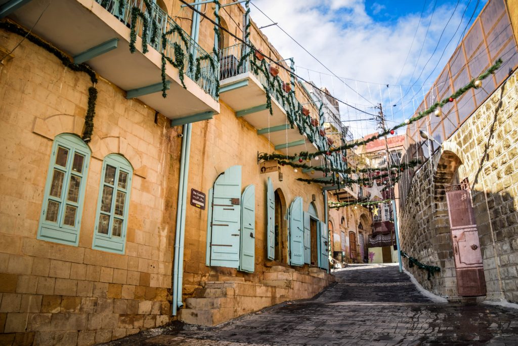
The last stop for today is As-Salt. Here nothing is better than simply walking around and admiring architecture from the Ottoman period. The city was the most prosperous when in the 20th century Ottomans established a regional administrative base here. But then, Amman was chosen as the new capital of the Empire of Transjordan and As-Salt lost its importance.

Check out Orthodox Church, Hammam Street Market, Ottoman Mosque, Salt Archeological Museum, Muhammed Al Bashir’s House and Abu Jaber Museum.

As-Salt, Jordan
As-Salt
As-Salt, Jordan
As-Salt
As-Salt, Jordan
As-Salt
As-Salt, Jordan
As-Salt
As-Salt, Jordan
As-Salt

Come back to Amman and spend your last night in one of the traditional restaurants, e.g. AlQuds.

Overnight: Sydney Hotel

Day 11 – Mount Nebo, Amman airport

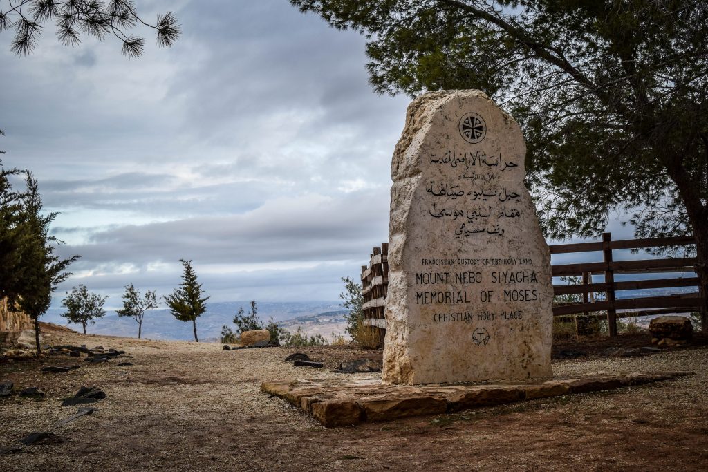
It’s around one hour from Amman to Mount Nebo. The place is mentioned in the Hebrew Bible as the one where Moses was granted a view of the Promised Land. Nowadays, the views are still amazing. The Dead Sea, the Jordan River Valley, Jericho, Bethlehem and the hills of Jerusalem in a distance. Drop by to the basilica and have a look at the Byzantine mosaics and serpentine cross sculpture. Nearby, there is the La Storia Tourism Complex with a bit kitschy exhibition but a great shop with mosaics and other souvenirs. Don’t be shy to negotiate the price.

Mount Nebo, Jordan
Moses Memorial, Mount Nebo
Mount Nebo, Jordan
View from Mount Nebo
Mount Nebo, Jordan
En route to Mount Nebo
Mount Nebo, Jordan
En route from Mount Nebo

Floor mosaic can be also viewed in Church of Saint George. If it’s closed, go to the nearby house and the owner will open it for you. Then… it is time to return the car and get ready for the flight back!

Questions? Contact me via Instagram or pinyourfootsteps@gmail.com